
The Block
 Rhode Islanders have a name for it.
“The Block.”
An island of less than 10 square miles, it lies less than 15 nautical miles off Rhode Island’s south coast and an equal distance from Long Island’s eastern tip. We approached from the west, leaving Montauk at 10 a.m. under a bright sky with gentle following breezes. From a distance, long low bluffs fringed much of the island, leading me to wonder if early explorers named the island after its blocky appearance. I later learned that it is named after Adrian Block, an early 17th century Dutch trader and navigator who first plied these waters.
(Trivial pursuit: Name the states that border Rhode Island. If you only answered Connecticut and Massachusetts, you are mistaken. Our chart shows a border at sea between Long Island and Block Island, which means New York and Rhode Island are neighboring states.)
Soon, we rounded the breakwater marking the channel into the Great Salt Pond and Block Island’s New Harbor. Though we had read online that the harbor is often overcrowded, we found loads of room and soon anchored in eight meters of water. Our 30-kg Bruce set securely on the first try.
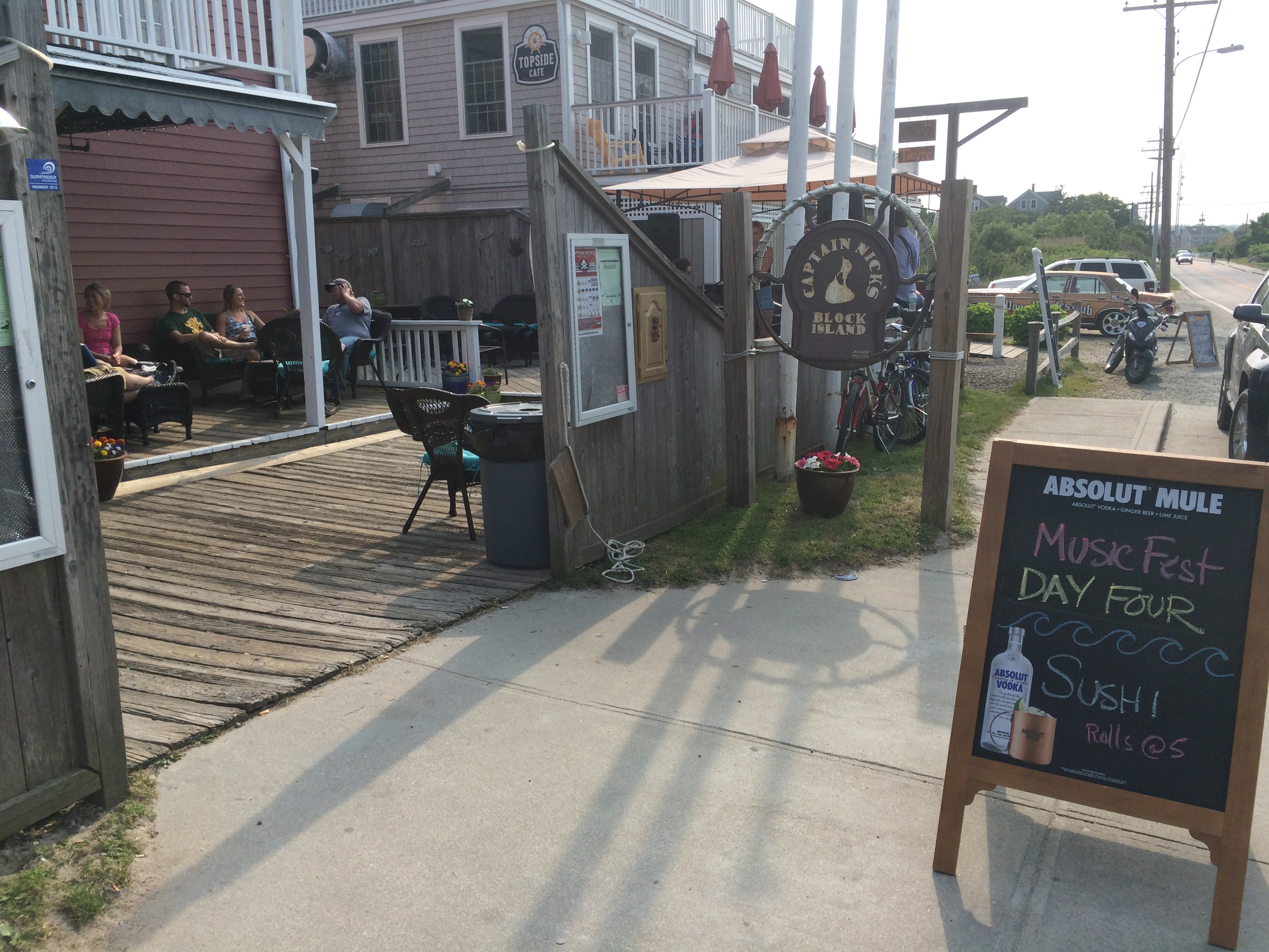
Heading ashore, we parked the dinghy at the Block Island Boat Basin. We weren’t sure where we were going, we just wanted to stretch our legs after the sail from Montauk. We were soon keeping pace with a friendly native named Stein who was walking our way. Stein was Norwegian but had lived on the island off and on, mostly on, for the better part of 20 years. He was headed into town to meet his lady for happy hour at Captain Nick’s, a local drinking establishment now on Day Four of a week-long music fest. Twenty minutes later, we found ourselves in soft lounge chairs under a warm sun toasting our new friends as live music wafted through our ears.
 A wicked wind blew across the anchorage all night, keeping Jocelyn awake. We noted slight movement in our transit overnight, raising concern about dragging. The wind was not forecast to abate until evening, so we opted to move to a town mooring ball close to the Boat Basin. A shorter dinghy ride later, this time with the Brompton’s, and we were again ashore, ready to explore.
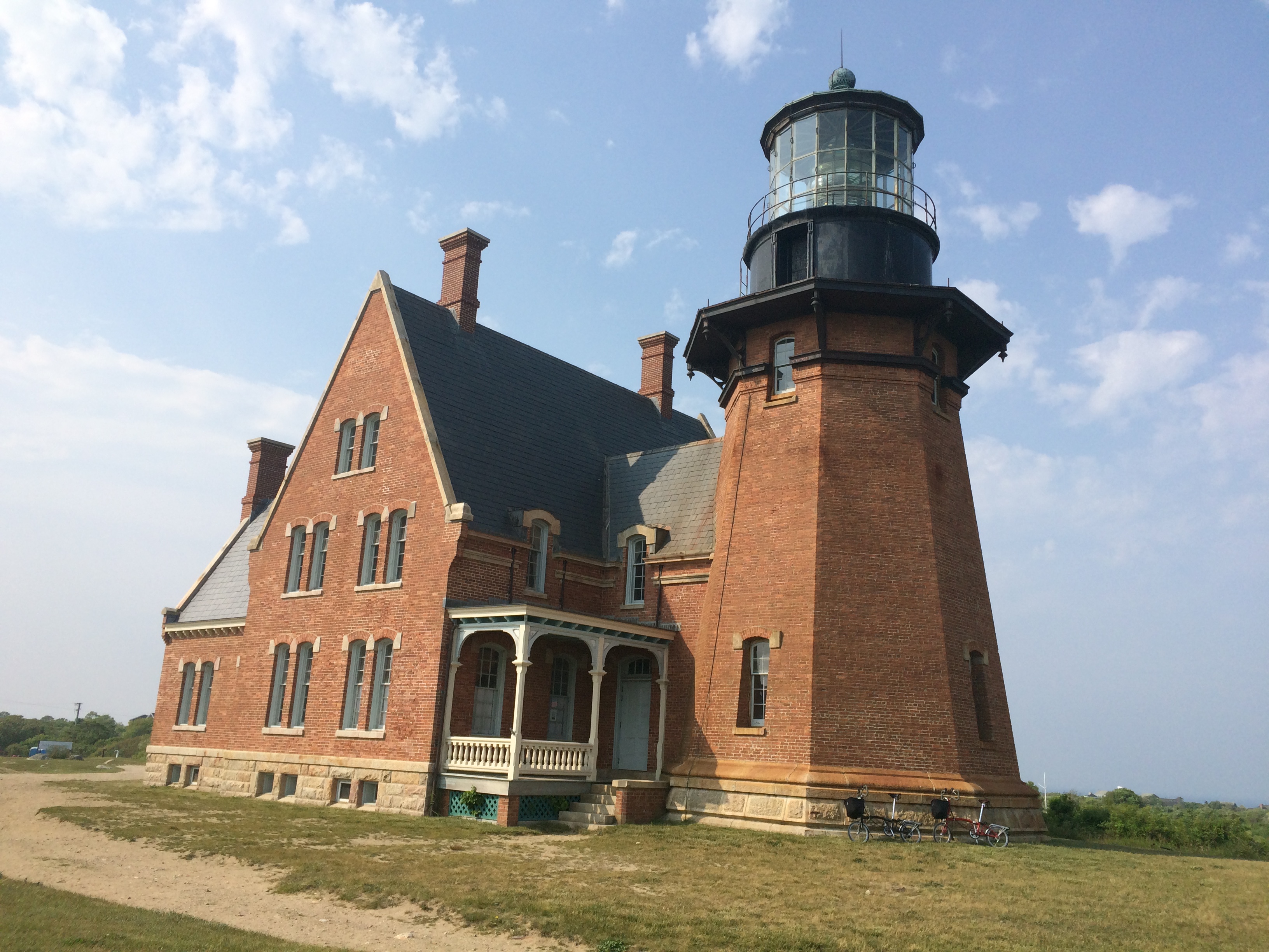
Our bike ride took us to the southeast lighthouse, one of two landmark lighthouses on the island. It was too early in the season to be open, but was none-the-less impressive from the outside. We learned that the lighthouse was moved some 248 feet away from the edge of the bluffs in 1993 due to the threat of erosion. We continued our tour with a stop at nearby Payne’s Stairway, a wooden staircase with more than 100 steps leading down the Mohegan Bluffs to the beach below. Time was short, so we pledged to return tomorrow.
 That night, Jocelyn slept better on the mooring ball. It didn’t hurt that the winds diminished significantly.
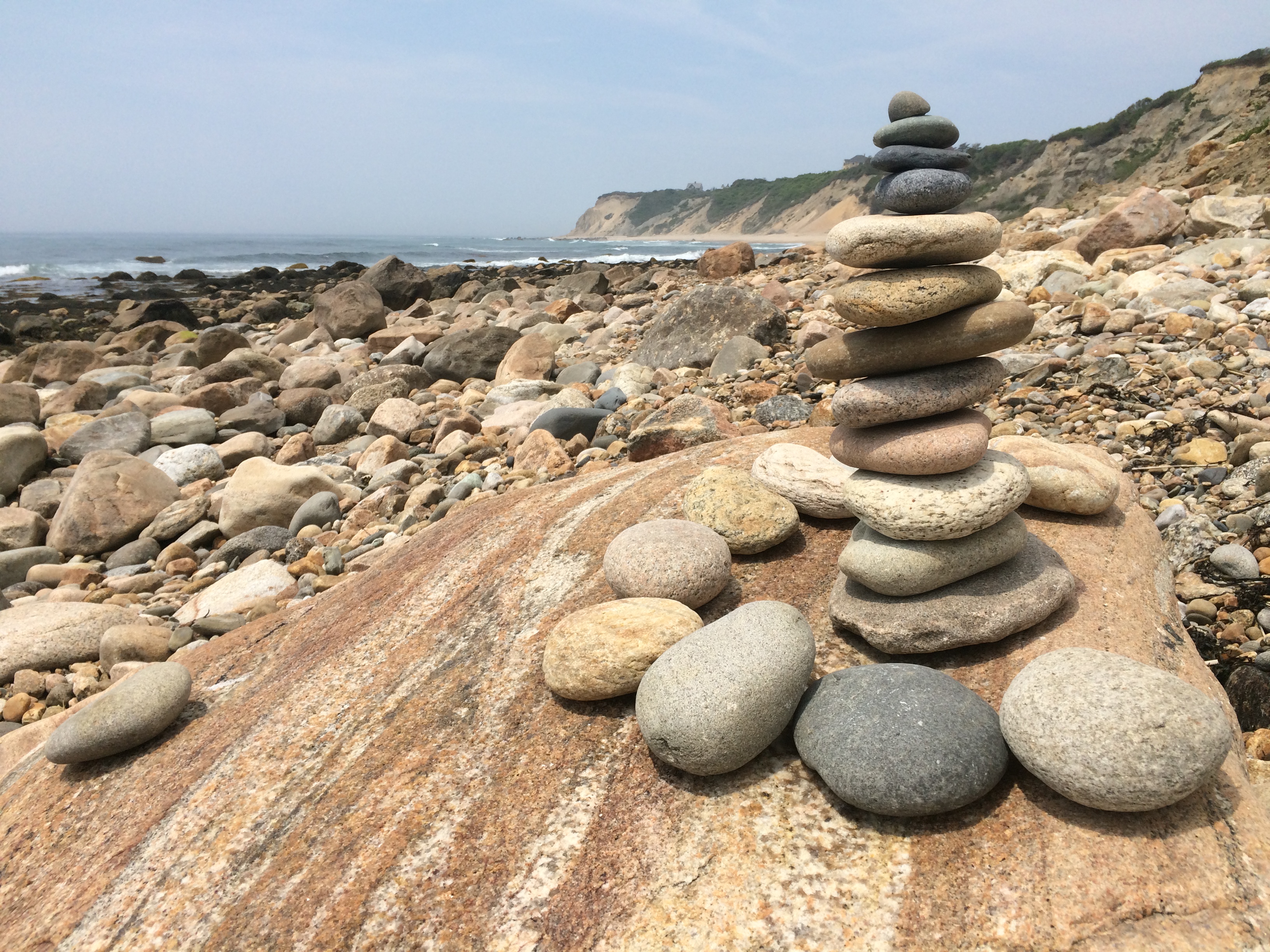 Our return to the staircase the next morning was rewarded with a delightful walk along the stone-strewn sandy beach at the base of Mohegan Bluffs. Hundreds of rock stacks dotted the beach, adding an artistic element to the natural beauty. No wonder the Nature Conservancy deems this island one of “the last great places.”
We looked carefully for one of the 550 orbs hidden around the island by a local artist. “The Glass Float Project” is a whimsical challenge to visitors and residents alike to scavenge for the orbs until all are found. We had no luck.
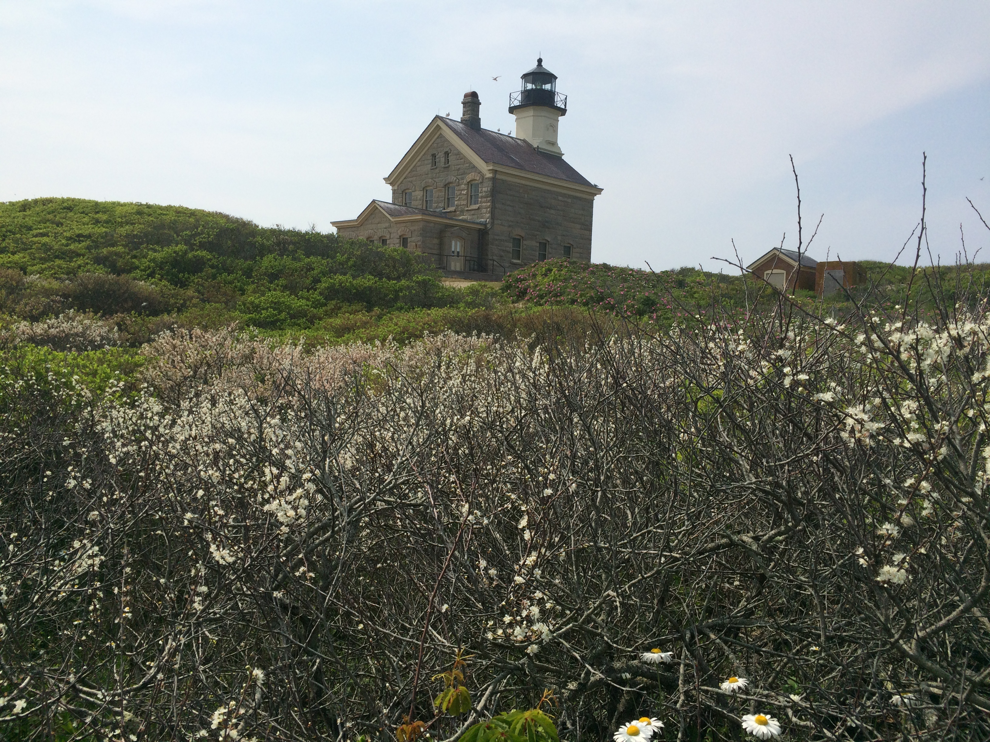
After lunch, we pedaled about 45 minutes to the other landmark lighthouse at the island’s northern tip. Surrounded by dunes, the area is part of the Block Island National Wildlife Refuge.
 Later, Uncle Bill arrived by ferry from Point Judith. We plotted the next day’s sail back to the mainland over Mud Slides, the signature drink at the Boat Basin watering hole, before dinghying back to the Windleblo at the end of the evening.
Comments
The Block — No Comments
HTML tags allowed in your comment: <a href="" title=""> <abbr title=""> <acronym title=""> <b> <blockquote cite=""> <cite> <code> <del datetime=""> <em> <i> <q cite=""> <s> <strike> <strong>