
Newfoundland’s Southwest Coast
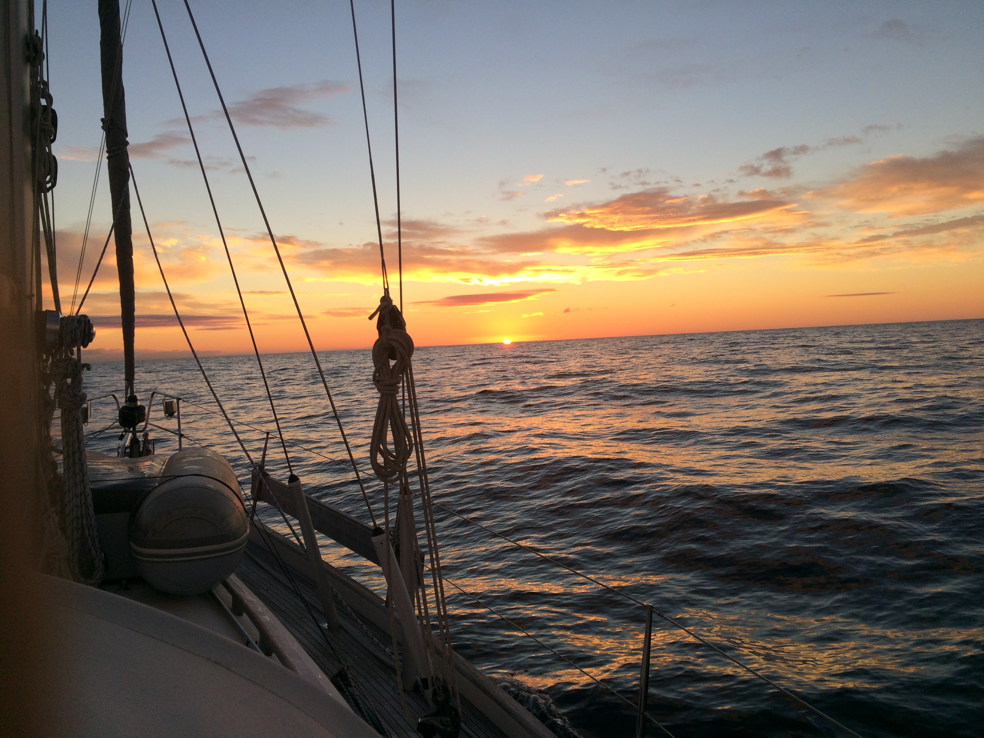
Crossing sunrise
Wild. Unspoiled. Beyond beyond. Stunningly beautiful.
These are words that come to mind upon seeing Newfoundland, at least the part of Newfoundland we’re in.
Our 85-nautical-mile overnight crossing from Cape Breton Island was smooth. Winds were lighter than forecast, so we mostly motor sailed through the night. It sure felt nice when the wind perked up from the northwest and we could shut down the engine. But, alas, the wind died and we had to fire up the iron sail once again.
We made landfall at a place called Isle aux Morts, which translates to “island of the dead.” Not a very auspicious place to land, eh? Seems many a ship have wrecked on the rocky Isle aux Morts shores over the years, and local folklore abounds about lost ships, crew, and passengers.
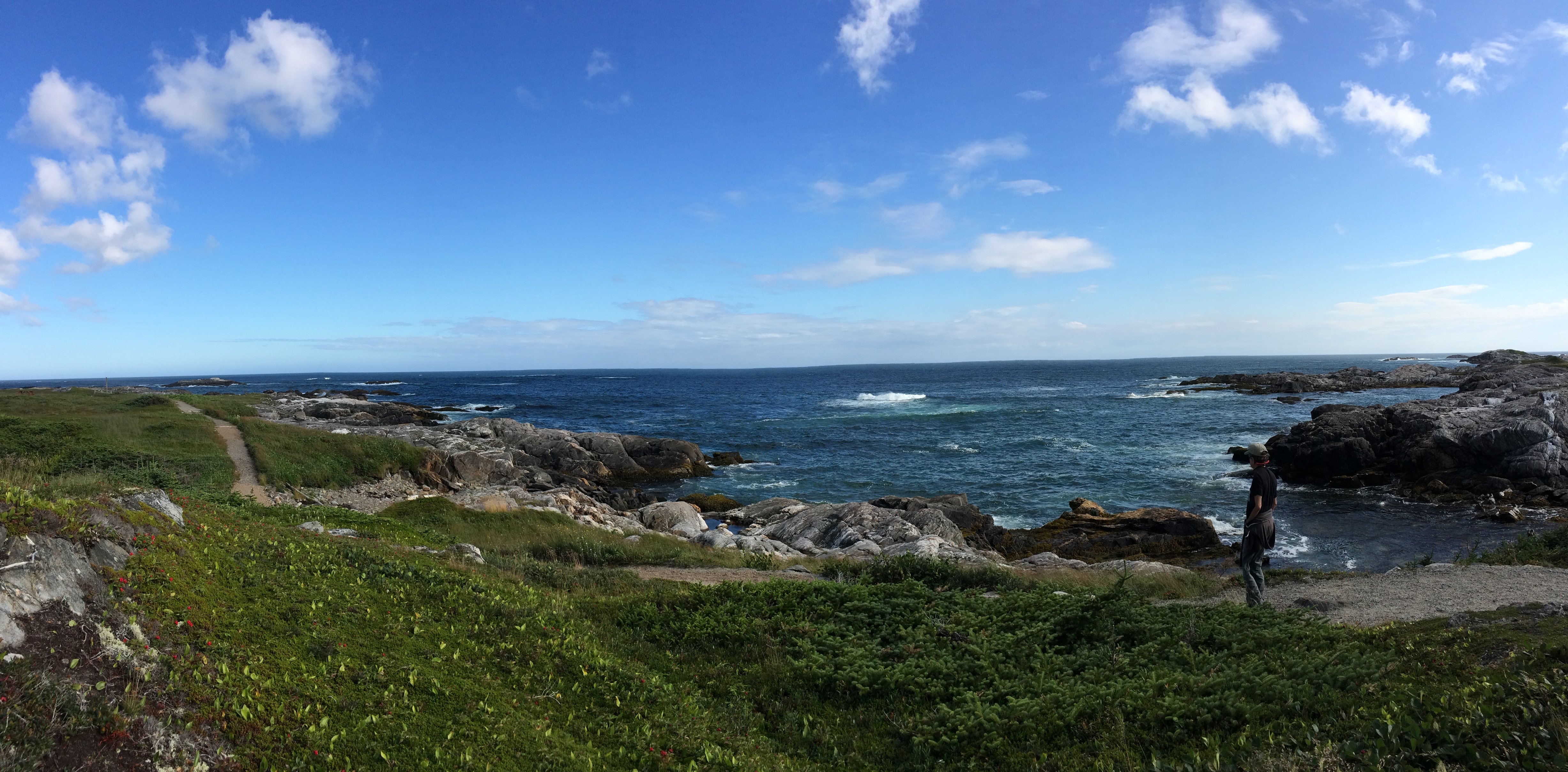
Harvey Trail, Isle Aux Morts
Not all souls perished, though, thanks to George Harvey, a 19th century Isle aux Morts fisherman who, along with his eldest daughter, Ann, and Newfoundland dog, braved cold turbulent seas to save more than 100 from watery graves. As the story goes, while his daughter rowed, he commanded his dog to take a line and swim 100 meters through the rough seas to the foundering vessel. The faithful dog returned with a heavier line, which Harvey used to bring the passengers to safety. Today, a shoreline nature walk called the Harvey Trail offers narrative and murals telling the tale.
We stayed at Isle aux Morts only long enough to walk the trail and catch up on sleep, leaving 26 hours after landfall to begin our exploration of Newfoundland’s southwest coast.

View from atop Barasway waterfall.
Our first stop was in “The Basin” above the small settlement of Harbour Le Cou. The Basin is nearly landlocked, well protected from both seas and winds. Off its western side runs a dogleg inlet connecting with a Barasway (a corruption of the French word “barachois,” meaning shallow inlet) about 600 meters in diameter. At the northern end of this pool is a 200-foot waterfall cascading down the rocks.
The anchor spot was deep, forcing us to drop the hook in about 13 meters and back the boat up to take a line to shore. Once installed, we launched the dinghy and proceeded to ascend the waterfall. We kept going, hop scotching the rocks about a mile further until we found an even more magical waterfall above. Decidedly warmer than the sea, the fresh water beckoned. We spent an hour swimming, sitting under the waterfall, and basking in the sun to dry off.

Drone ready for liftoff
It was here at the Barasway that Andrew first launched the drone.
You’d expect a freshly minted Air Force guy to bring a drone on a sailing expedition, right? Well, perhaps not, but that’s exactly what’s happened. Backpackable, the drone is about two feet square and a foot tall, with four removable propellers, two rails for a base, and a high quality camera swivel-mounted on its underbelly. Not quite a toy, it’s a precision tool, but Andrew is using it like a plaything, mainly because it is fun with a capital F-U-N.
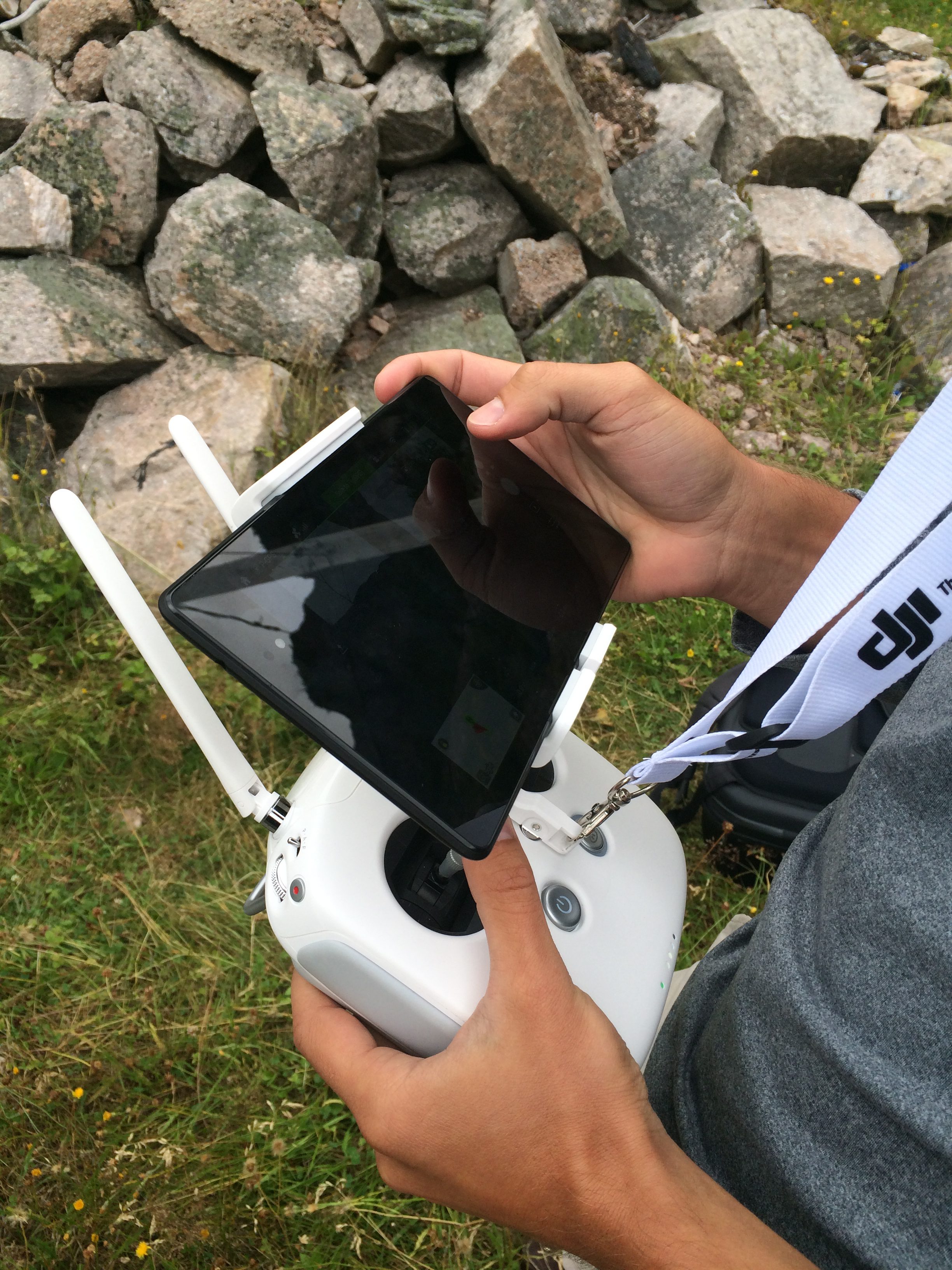
Control tablet
To get it going, Andrew unfolds the antennae, screws on the propellers, then dons the control tablet, which hangs around his neck mounted in a bracket/joystick assembly. A few pre-flight checks later, it lifts off, emitting a mosquito-like buzz as it goes. High into the sky it flies, low over the water, up and down, taking video all the while.
Ten minutes or so into the flight, the battery signals time is up. Andrew guides it in until it hovers within reach. He grabs one of its base rails and turns off the propellers. Then, he loads it in its pack and slings it onto his back.
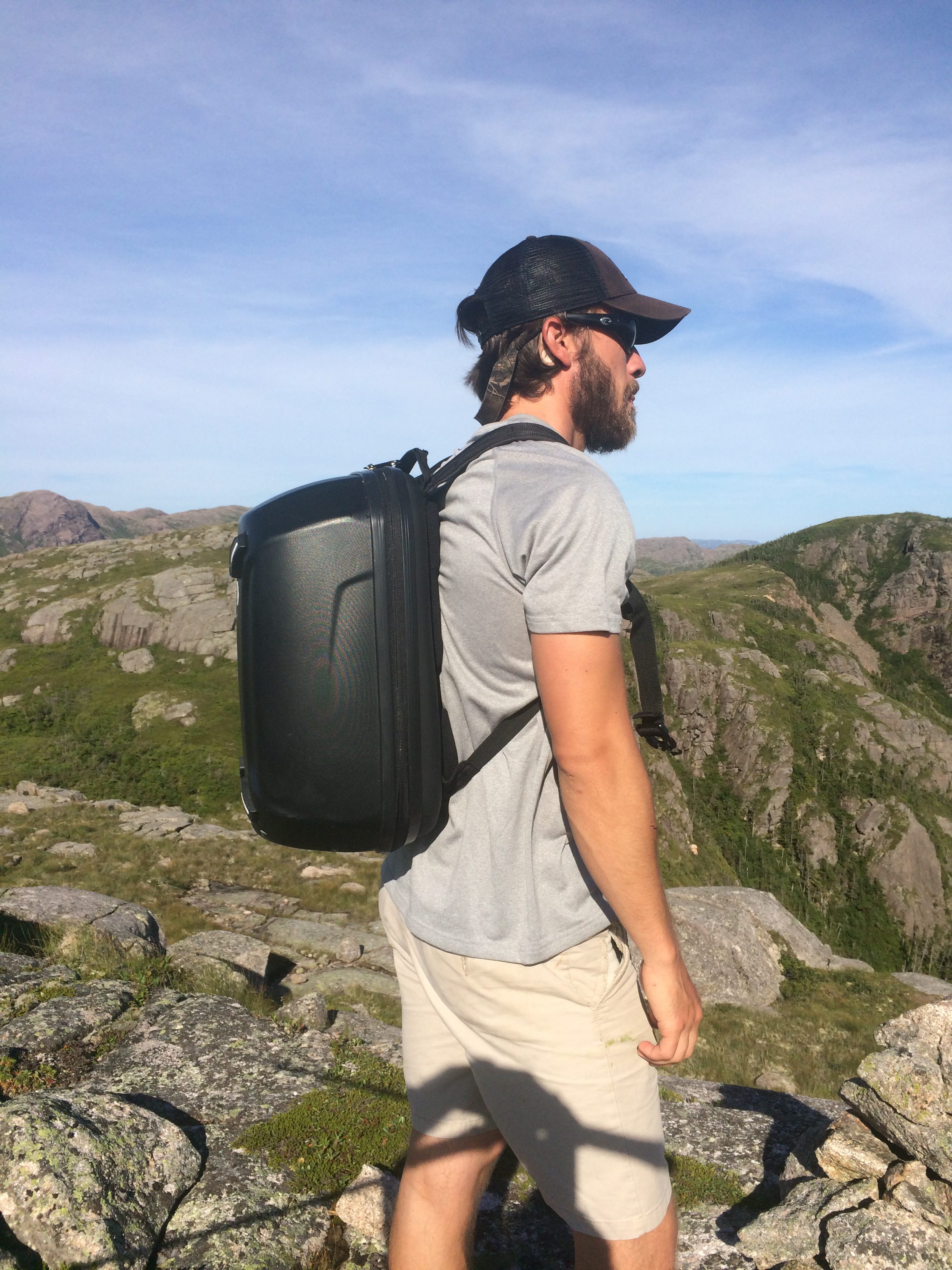
Drone backpack
Our Newfoundland expedition just became a video shoot! We now have a new mission. Mission #1: Teach Andrew how to become a cruising sailor. Mission #2: Have fun producing Windleblo video. Both while cruising through some of the most spectacular scenery anywhere.
After two nights in The Basin, we decided to head for Grand Bruit (pronounced gran brit), the first “outport” we have seen.
Our Pilot Press cruising guide book explains outports. “For years the life blood of the outport was family cod fishing, drying split fish on racks and salting them down. This fishing was done from open dories, usually rowed back and forth to the fishing grounds Consequently the ‘settlements’ grew around protected harbors near the fishing grounds without regard to access from shore. The advent of the offshore fishing (on sailing schooners) and ‘one lunger’ or ‘make and break’ engines encouraged the fishermen to concentrate living in the better protected harbors.
“After 1949, when Newfoundland became a Canadian province, more fish processing plants were built in centralized villages around the coast. Fishermen gradually moved from the outports to these better paying and more reliable jobs.

Grand Bruit
“In the early 1950s Newfoundland’s first premier, Joey Smallwood, began to offer outport citizens incentives to relocate, primarily to reduce the cost of providing the whole range of social services to the remote settlements. The government sponsored resettlement programs implemented between 1954 and 1975 were hugely controversial.
“After considerable discussion the provincial government implemented a policy to assist resettling families financially. Initially this policy consisted of paying the owner of a boat for the transportation of all belongings, including houses, to the new center. The policy was soon replaced by payments of up to $150 to each family. In order to receive this subsidy, which was later raised in steps from $200 to eventually $600, every member of the community had to agree to be relocated. (To put this into perspective, at that time, an individual engaged in the inshore fishery earned less than $500 annually.)
“In 1965 a new Federal/Provinciial “Resettlement Program” was introduced that provided $1000 per household plus $200 for each dependant (sic). In addition the costs of moving, including house transportation, were provided. To be eligible for this assistance, people had to move to a designated ‘growth center’ and some 90% (later 80%) of the households in the community were required to resettle.
“In 15 years over 20,000 people moved from over 300 isolated coves and islands, some to better paying jobs, some to bitter disappointment; but all to a radically different lifestyle from that of the outport. Some outport residents demolished their homes, others towed them to a new site, while others just left, the kitchen table set for the next meal in the hope of returning. The process is still ongoing. In 2008, Petites, on the southwest coast, saw the last of its citizens move away.”
Grand Bruit coast.
In Grand Bruit, we saw a prime example of the outport. Many homes ringed the harbor and its abandoned fish factory; only a handful were occupied, and these by summer-only residents. The ferry used to visit regularly but no longer does. The community is virtually dead.
Other than by water, there is no way into the outports. A road runs eastward from Port aux Basques as far as Harbour Le Cou. But from there for more than 100 miles, there isn’t a single road to all the fjords and outports along this coast.
We leave Grand Bruit and probe deeper into the wild.
Comments
Newfoundland’s Southwest Coast — No Comments
HTML tags allowed in your comment: <a href="" title=""> <abbr title=""> <acronym title=""> <b> <blockquote cite=""> <cite> <code> <del datetime=""> <em> <i> <q cite=""> <s> <strike> <strong>