
The Saint Lawrence Seaway
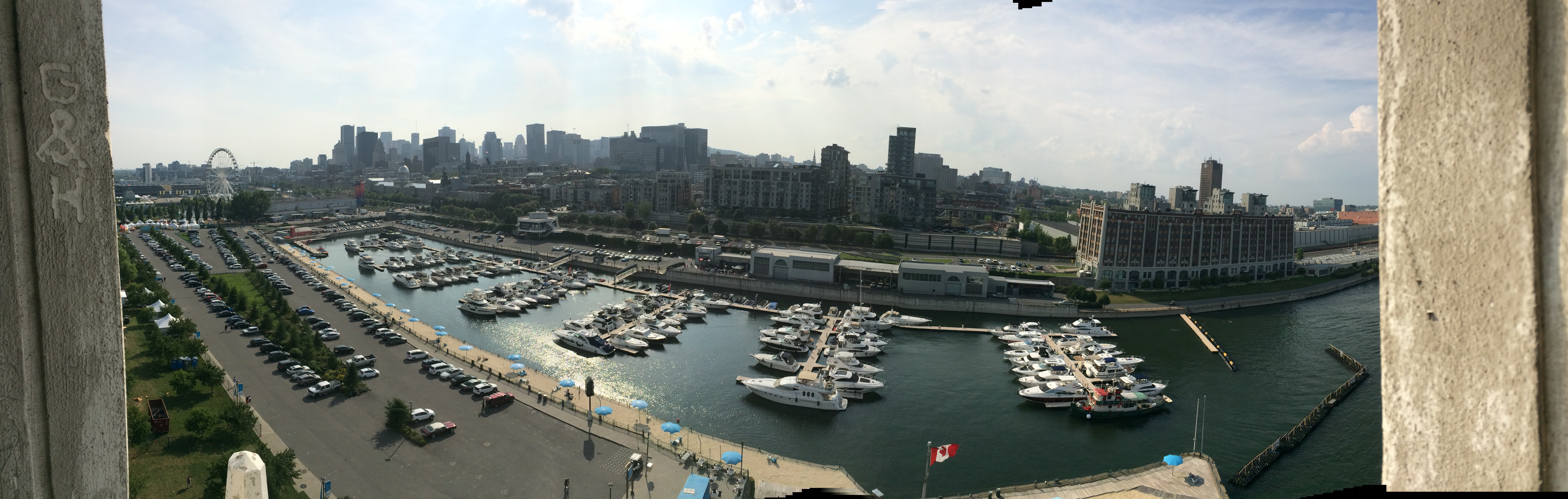
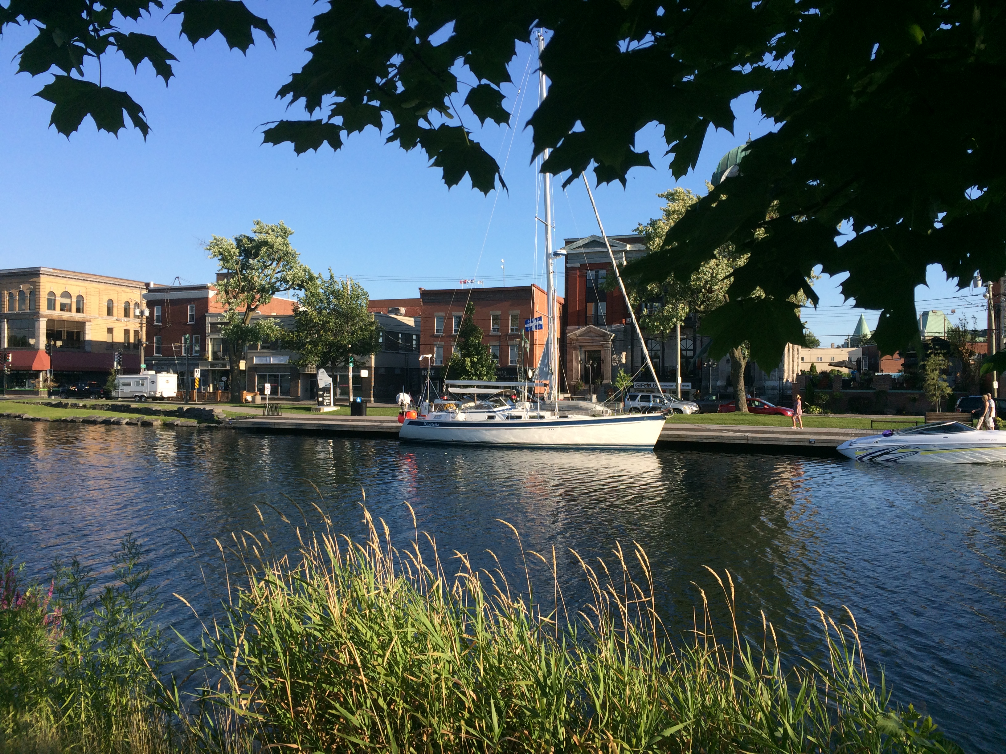
View of Yacht Club de Montreal from Quai D’Horlage
We are at the mouth of Lake Ontario in the Thousands Islands. I push the altitude button on my Casio Pathfinder wristwatch. 150 meters comes the readout. How did Windleblo climb so high? The St. Lawrence Seaway!
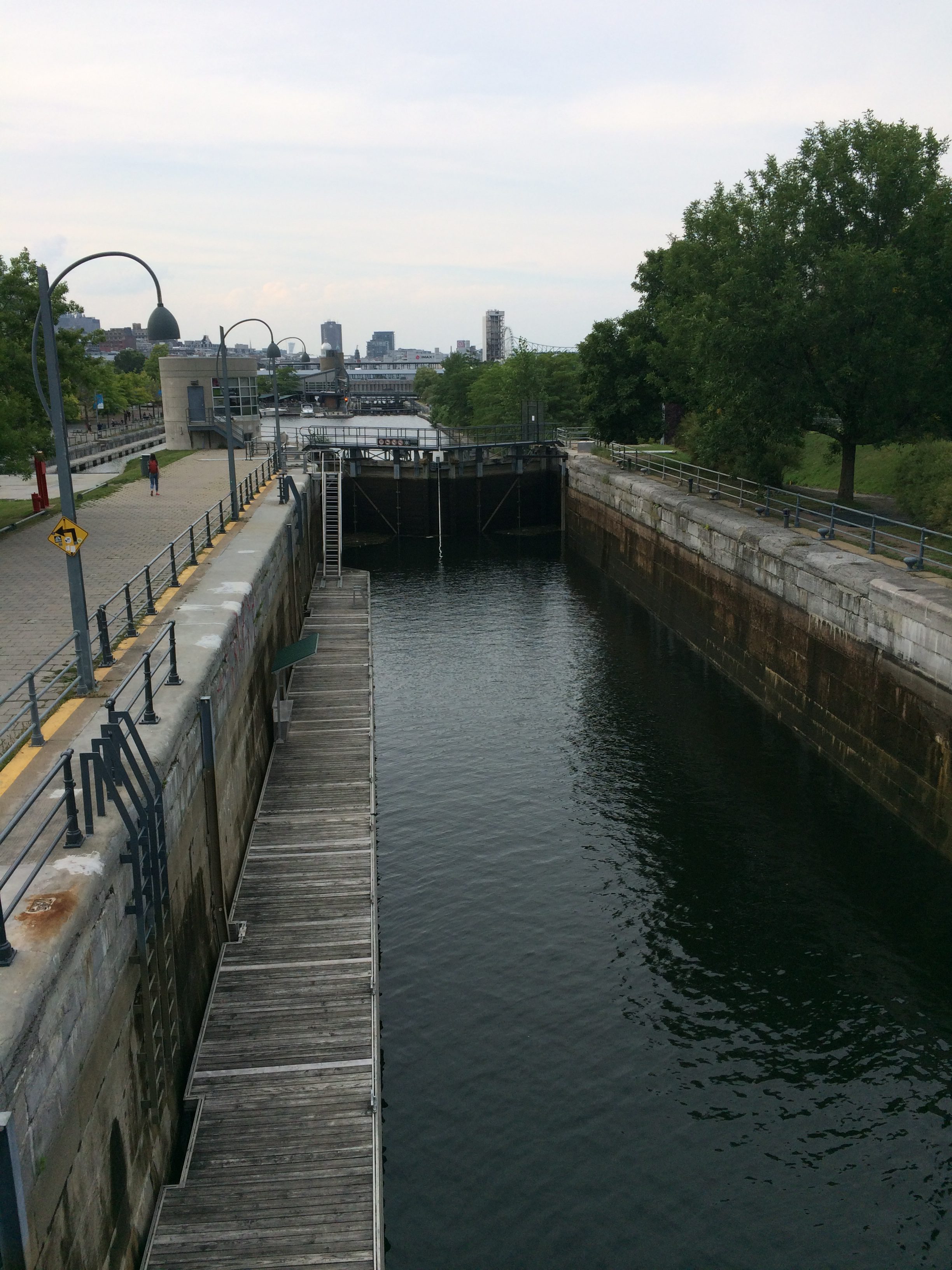
Lachine Canal lock
Since 1535, when Jacques Cartier was barred by the Lachine Rapids in Mount Royal (now Montreal) from proceeding up the St. Lawrence River, it became a dream to connect the Atlantic Ocean with the Great Lakes by building a way around the rapids and strong currents of the St. Lawrence River. The Lachine Canal, built in the early 19th century was a start, but that only opened the way west a bit. More was needed.
In 1895, the first joint U.S.-Canada commission was established to study the feasibility of a seaway. In 1909, an International Joint Committee was formed to investigate. In 1932, Canada and the U.S. signed the Great Lakes-St. Lawrence Deep Waterway Treaty, and in 1941, they signed the Great Lakes-St. Lawrence Basin Agreement. In 1949, another commission studied the idea, but not a single spade of dirt was turned. All the while, powerful U.S. railroad and industrial lobbying interests successfully foiled progress.
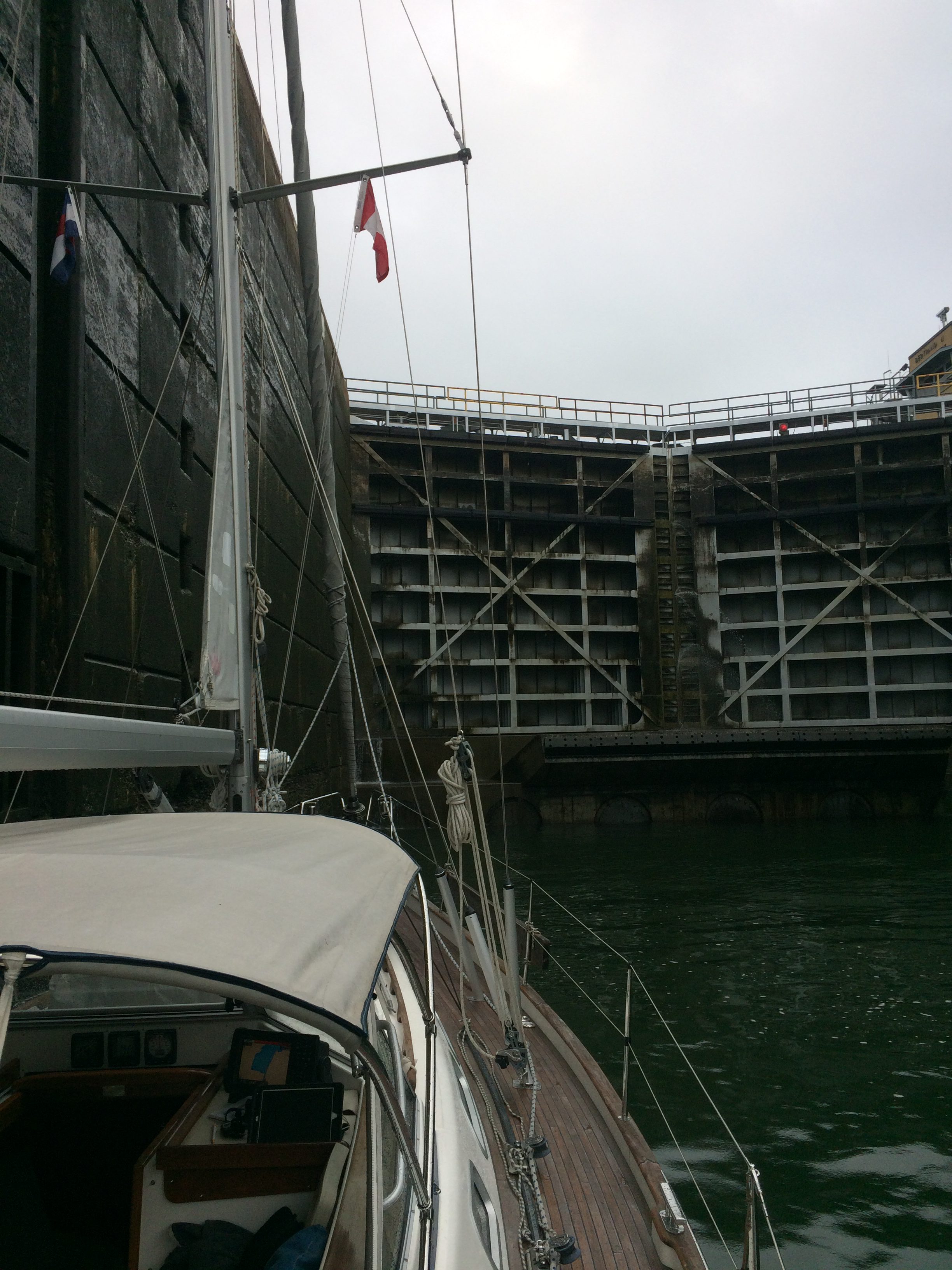
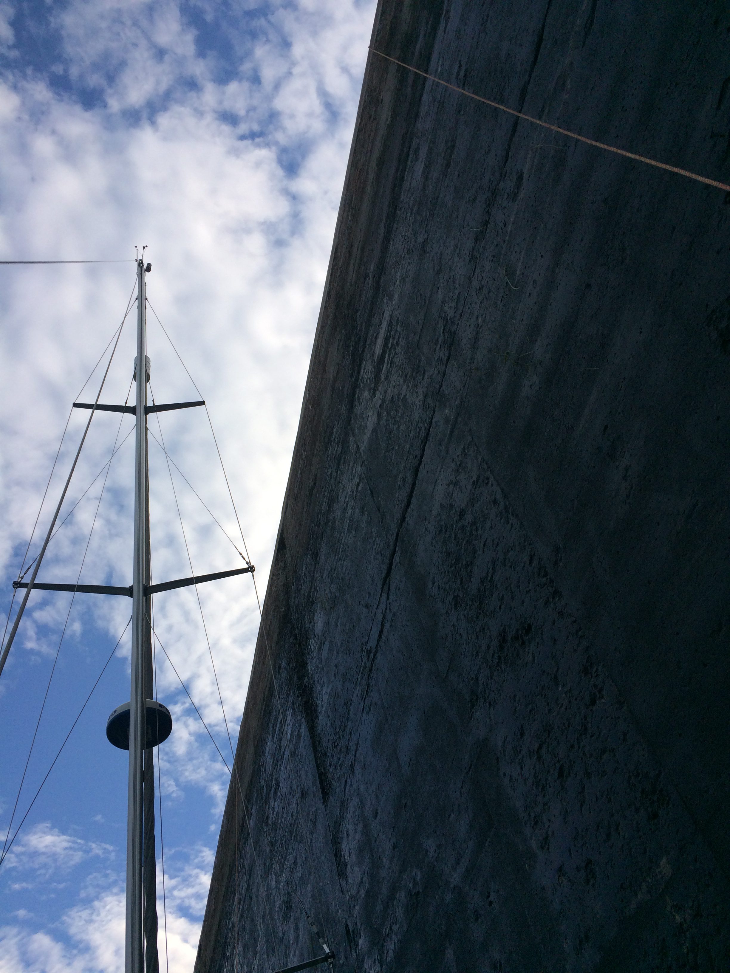
Inside St. Catherines lock
In 1951, Canada finally got tired of waiting. It announced it would build a seaway alone. Canada passed the St. Lawrence Seaway Authority Act and the International Rapids Power Development Act to begin work west from Montreal. The ploy worked. The U.S. joined Canada in power works in the International Rapids section of the river, the first joint work on the Seaway.
In 1954, the United States joined Canada in building the Seaway with the passage of the Wiley-Dondeo Act. The agreement reached between the two countries estimated the cost of the project at $470.3 million, with Canada paying $336.5 million and the U.S. paying $133.8 million. The St. Lawrence Seaway was completed in 1959, officially opened by Queen Elizabeth II and U.S. President Dwight Eisenhower.
The Seaway system is connected by six canals with a total length of about 100 km (60 miles). The 19 locks are filled and emptied by gravity. Each lock is 233.5 meters long (766 feet), 24.4 meters wide (80 feet), and 9.1 meters deep (30 feet) at the entrance sill. Ships are raised 180 meters above sea level. (This total includes the rise up to Lake Superior, so my Casio can’t be off by too much.)
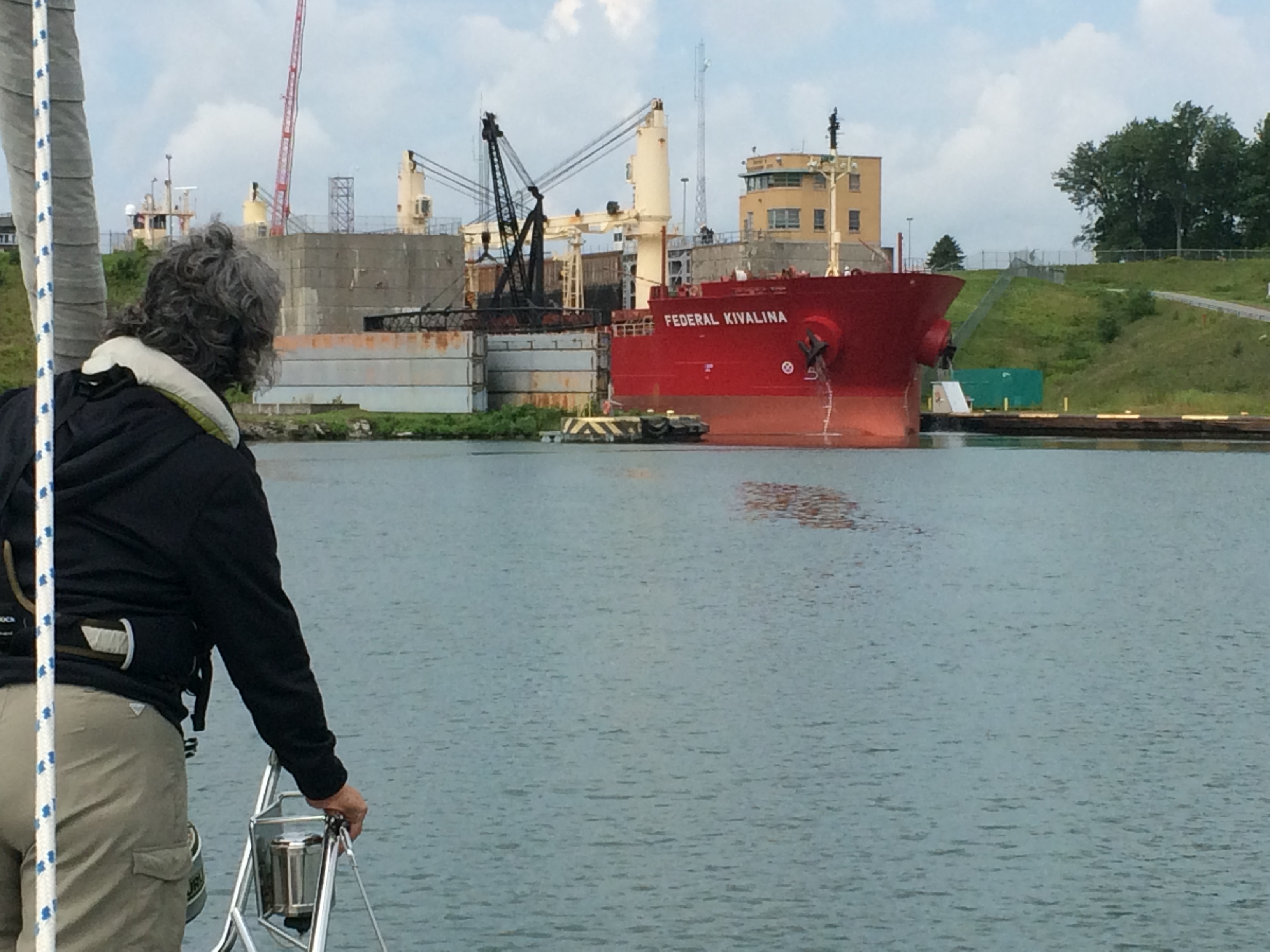
Watching a laker exiting Eisenhower lock
I asked Jocelyn what impressed her most about the trip upriver from Montreal.
“The size of the locks! And the size of the ships that go through them!” she exclaimed. “I liked the friendly lock keepers, and the friends we made on the boat we rafted with going through some locks,” she added.
Probing, she offered more.
“I enjoyed the river anchor spots and the little town of Valleyfield where we tied up to a dock in the old canal. Also, I liked the American locks best.”
Between Montreal and Lake Ontario, there are five Canadian locks and two U.S. locks. The first two – St. Lamberts and St. Catherines – are Canadian locks on the South Shore canal connecting Montreal to Lac Saint Louis.
The morning of August 12th dawned grey and damp, adding to our anxiety about encountering our first St. Lawrence Seaway locks. Though we are veterans of many lock transits – the Gota Canal, the Caledonian Canal, for example – these Seaway locks would dwarf any we had experienced before. Getting ready, we researched different sources to help us understand our way up the river. Some online user postings referenced boiling waters and jammed fender boards, especially for upbound boats (like us!). These had a way of injecting doubt and fear as we prepared for the unfamiliar. Jocelyn gamely pushed her fears aside as she cast us off from the safety and security of our Yacht Club de Montreal slip at 7:23 a.m.
It didn’t take long for us to learn our first lesson…patience! We reached the lock entrance in about 45 minutes. The official website said the locks open for business at 9 a.m. and we wanted to be among the first through. All day until 8 p.m., pleasure craft would be worked through the locks as long as there were no commercial vessels taking priority. The same website also posted a “scheduled opening” of 11 a.m., August 12th, when pleasure craft would be guaranteed transit.
Which post to follow? The one that says pleasure craft are worked through all day, commercial traffic permitting, or the one that guarantees transit at a scheduled time? We optimistically opted to follow the first. Before departure, we had checked both online at marinetraffic.com and using our onboard Automated Identification System (AIS) and saw no commercial traffic competing to use the St. Lambert lock anytime that morning.

Odyssey VIII skipper
Each lock has a special waiting dock for pleasure craft. The Seaway’s “Pleasure Craft Guide” instructs arriving boats to “call the lock control using the dock telephone and you will receive your instructions.” Picking up the phone, I announced our arrival, hoping to hear that the lock doors would open for us right away. Instead, I was told to stand by until 9:45 a.m. when instructions would boom over the dock’s public address system. We started cooking breakfast as the drizzle continued.
Over the ensuing hour and a half, three things happened. We filled our bellies, the sun came out, and several other boats joined us at the waiting dock.
Oddyssey VIII crew at the ready
One of them was the Odyssey VIII, a Beneteau 38 skippered by a Quebecois named Norman. His daughter, Emily, and her best friend, Cynthia, were joining him to deliver the boat to the Thousand Islands where Norman and his partner, Suzanne, would spend three and a half weeks on vacation. Over the next four hours, we would get acquainted as we worked our way along the South Shore Canal.
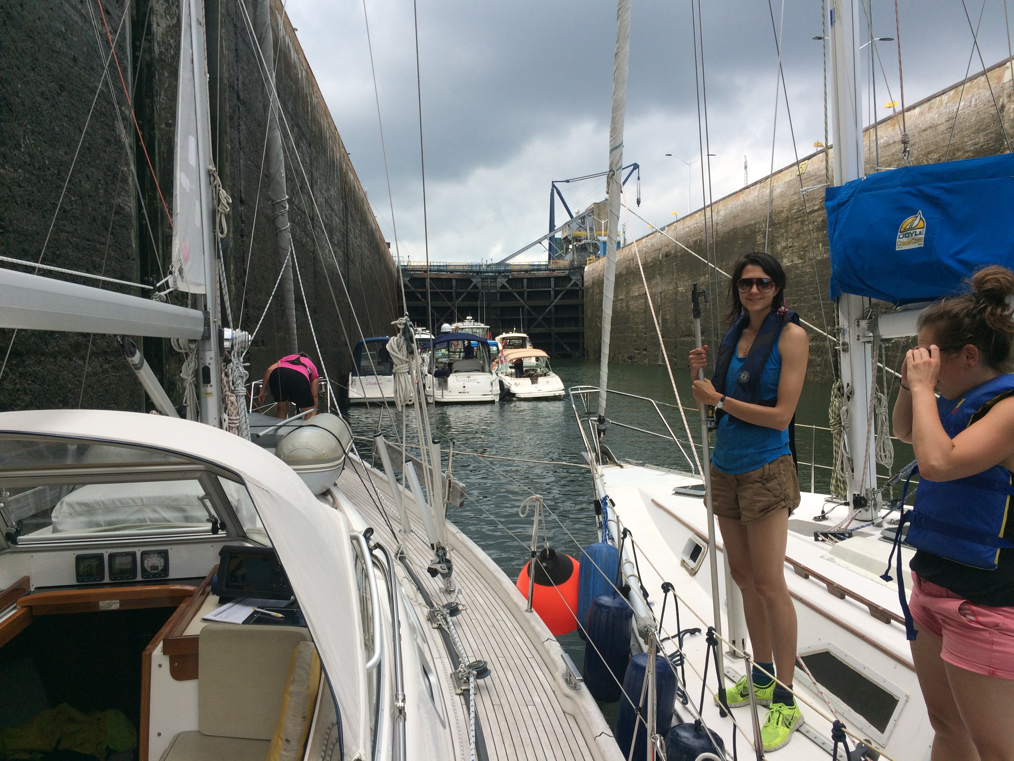
Norman had been through the locks many times before. He assuaged our concerns about roiling waters and chafing fenders. Odyssey VIII and Windleblo would raft up in the two locks. As the larger boat, Windleblo would hug the lock wall. Cynthia and Emily would help fend us off.
Lock doors closing
Jocelyn quickly bonded with the new temporary crew. Both were in their late twenties. Cynthia was a Human Geography PhD student at the University of Toronto but living in Montreal. She was about to embark on an extended research trip to India and Singapore investigating the fate of precious metals recycled from electronics. Apparently, no one really knows how this market works. Discarded electronics end up in India where precious metals are extracted by people working in hazardous conditions. The metals end up in places like Singapore where they work their way back into circulation. Her dissertation will shed light on the deplorable circumstances of the Indian workers in hopes of prompting industry to accept responsibility for the full costsof their products. Emily works for an organization that teaches indigenous people in northern Canada.
Finally, the lock gates opened. We cast off from the dock and moved toward the entrance, preceded by four power boats and followed by Odyssey VIII. As soon as we took position, the lock master on the top
of the wall high above us dropped two long polypropylene lines, one fore and one aft, to help us control the boat. Jocelyn had placed fenders all along the port side rail to keep the boat from scraping the lock wall as we ascended. While Norman helmed her into position, Cynthia and Emily handed us Odyssey VIII’s lines, then came aboard with boat hooks to fend off the wall.
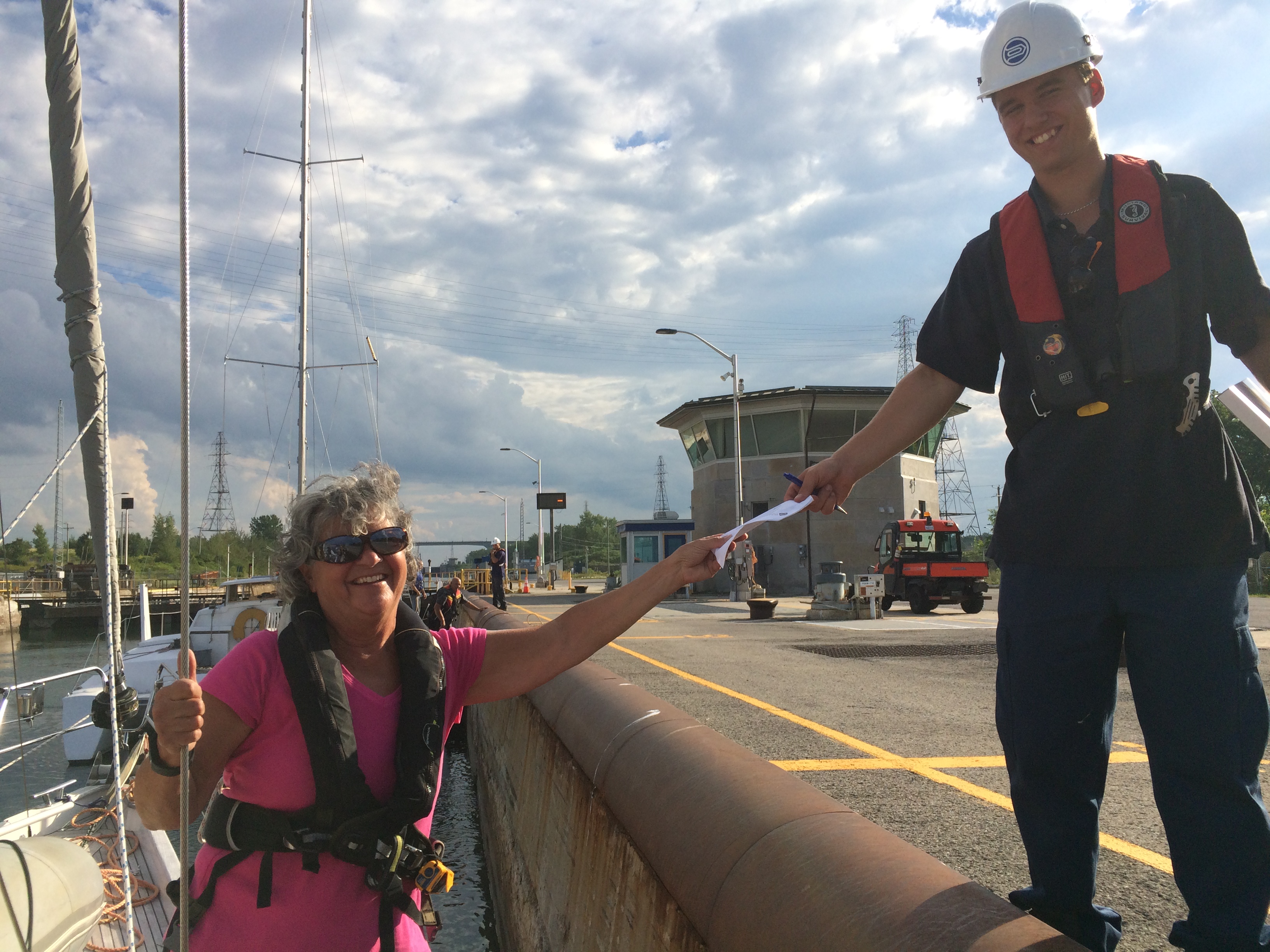
Before we realized it, we were rising. A slight current pushed us forward, but not enough to cause any problems. Inch by inch, the lock walls started getting shorter. Fifteen minutes and six meters up later, the filling stopped and the upstream lock doors opened. We handed the lock master our receipt for the $25CAD toll and were waved on.
We paced Odyssey VIII the seven nautical miles between the St. Lambert and St. Catherines locks and then repeated the process, this time waiting only 45 minutes for the lock gates to open, allowing us
Paying the lock toll
in. Rafting again with Odyssey VIII, all went smoothly. We left the lock intending to keep pace with Odyssey VIII through the Beauharnois locks 17 nautical miles upriver, but when we got there the lock gates were opening and Odyssey VIII was 30 minutes behind us. They missed the opening and would have to wait for the next chance.
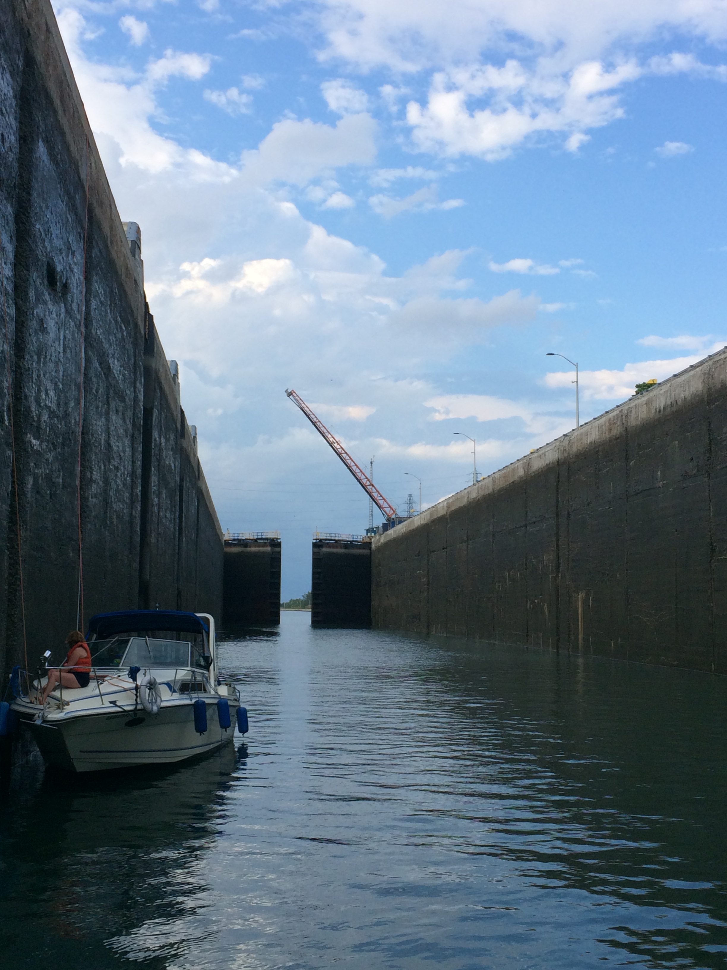
The Beauharnois locks are slightly different. Still Canadian locks, the lock masters drop lines to you as you enter, but this time you hug the starboard wall. There are two locks in rapid succession, with only a half-mile canal separating them. The lock walls are a lot taller when the locks are empty, evidence of an even greater lift when full – 14 meters! Another difference was that the first Beauharnois
Train rumbling by.
lock had a railroad swing bridge adjacent to its upstream gate. A train clacked by as we were rising!
It was just the two of us now, Jocelyn on the bow and me at the stern, each tending a line. Some current pushed the boat around a little, but again not enough to cause concern. Occasionally, we would have to reach out with our hand and push the boat away from the wall as the lock filled. At the top of the first Beauharnois lock, we again handed the lockmaster our payment receipt and off we went.
We made it as far as the Saint Louis lift bridge and pulled over for the night, anchoring in eight meters of water along the left bank of the canal. The current was still quite
Looking up at tall lock walls
noticeable as 85 percent of the St. Lawrence River water is diverted through this canal to flow through the Beauharnois hydroelectric plant adjacent to the lower lock.
As the sun set, we toasted our great start to the Seaway, knowing more was ahead.
The next day, we navigated through two lift bridges across the canal, the Saint Louis Bridge and the Valleyfield Bridge. Like the locks, commercial traffic takes precedence, and we would be obliged to wait until the “big boys” passed through before we would be allowed to pass. Before weighing anchor, we checked our AIS for traffic and, seeing a break, weighed anchor and hailed the Saint Louis Bridge operator on VHF channel 68 requesting transit. She lifted the bridge right away and we proceeded.
Not so lucky at the Valleyfield Bridge five nautical miles later, we
Windleblo in Vieux Canal berth
were informed that we would have to wait 45 minutes for commercial traffic. We pulled over and turned off the engine, letting the current slowly push us back downstream. Finally, the bridge lifted and we advanced.
Our short day ended with a tie up at a dock in the Vieux Canal (old canal) of Salaberry de Valleyfield, a nice little Quebec town at the mouth of Lac Saint Francois just upstream from the Beauharnois Canal. Here, we reprovisioned and found a serviceable restaurant for dinner, exploring the area a bit on the Bromptons.
Just as in the rest of Quebec, the Route Verte covers Valleyfield with excellent bike routes, lanes, and paths.
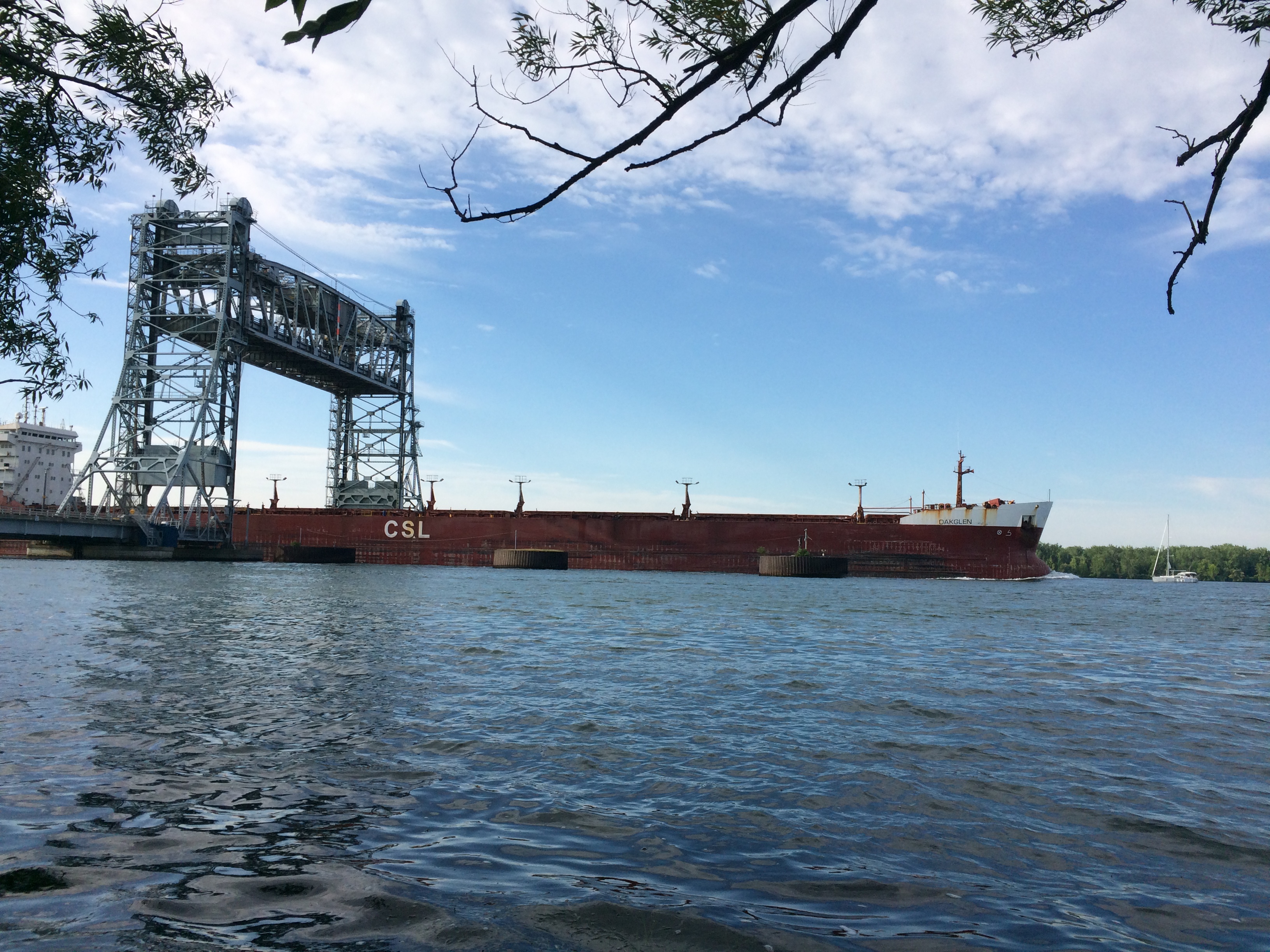
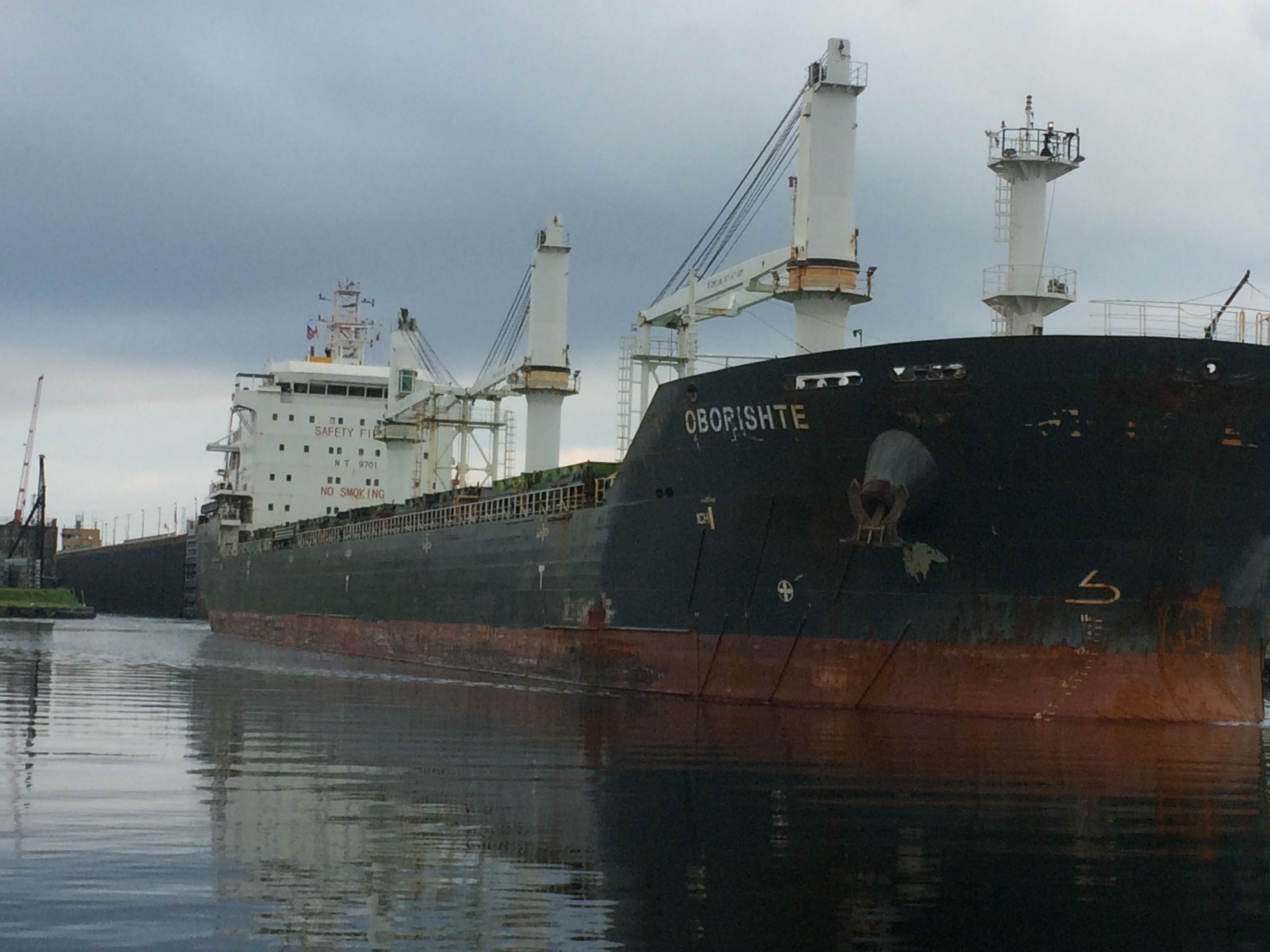
Laker transiting Valleyfield Bridge with sailboat nearby
Finding the park-like route to the canal, I cycled back toward the Valleyfield Bridge to watch from the shore as a “big boy” went under headed upstream. As luck would have it, a sailing vessel, probably about our size, was transiting downriver at the same time. Side-by-side, one could see the relative size difference of the two.
A plaque on the river bank informed us about the ships: “The largest ships to ply the waters of the Seaway are the “Lakers.” These ships average 200 meters (about 600 feet) long with a cargo capacity of 16,000 tons with the largest at 1,000 feet and a capacity of 50,000 tons. The “Salties” or seagoing ships average 150 meters (about 450 feet) long with the largest being 215 meters (about 799 feet) long. The total tonnage moved through the Lake Ontario-Montreal section has averaged more than 55 million tons over the past 10 years. Since 1971, the shipping season has averaged 265 days or nearly nine months from late March to mid-December. Today, the annual direct income benefits to the U.S.-Canadian Great Lakes Ports are estimated to be over $1billion from commerce moving through the Seaway’s Lake Ontario-Montreal section.”
Tied to a dock in the Vieux Canal in Valleyfield, we slept well. We needed to be rested for the onward push upriver. The next locks were the American locks.
But before the locks, a day-long motor through Lac Saint Francois faced us. This lake, like the two others along the Seaway, was created when a stretch of the valley was flooded by a dam built to funnel water through hydroelectric power plants and canals and locks where ships could navigate. As with many other dams, whole villages, many farms, and countless lives were disrupted to make way for the Seaway. The plaques paying tribute to the Seaway that we saw along the way paid scant attention to this part of the Seaway legacy.
Calling these bodies of water lakes is almost a misrepresentation. Studying the nautical chart clearly reveals the lake as a flooded valley, with narrow channels cut through broad shallower areas. Most of the shallows were unsuited for our deeper draft ocean going sailboat, forcing us to stick pretty closely to the charted channel. Consequently, while we tried to stay to the edge of the channel to avoid the worst of the current and perhaps even catch a helpful eddy, our progress was continuously impeded by water relentlessly pushing us back. Even in the lake, a current up to a knot and a half fought us all the way.
We ended the day at a delightful anchorage right in the middle of a small braid in the channel near the mouth of the lake adjacent to an island called Ile Chatelain. This would be our last night in Quebec.
Laker inside Eisenhower lock
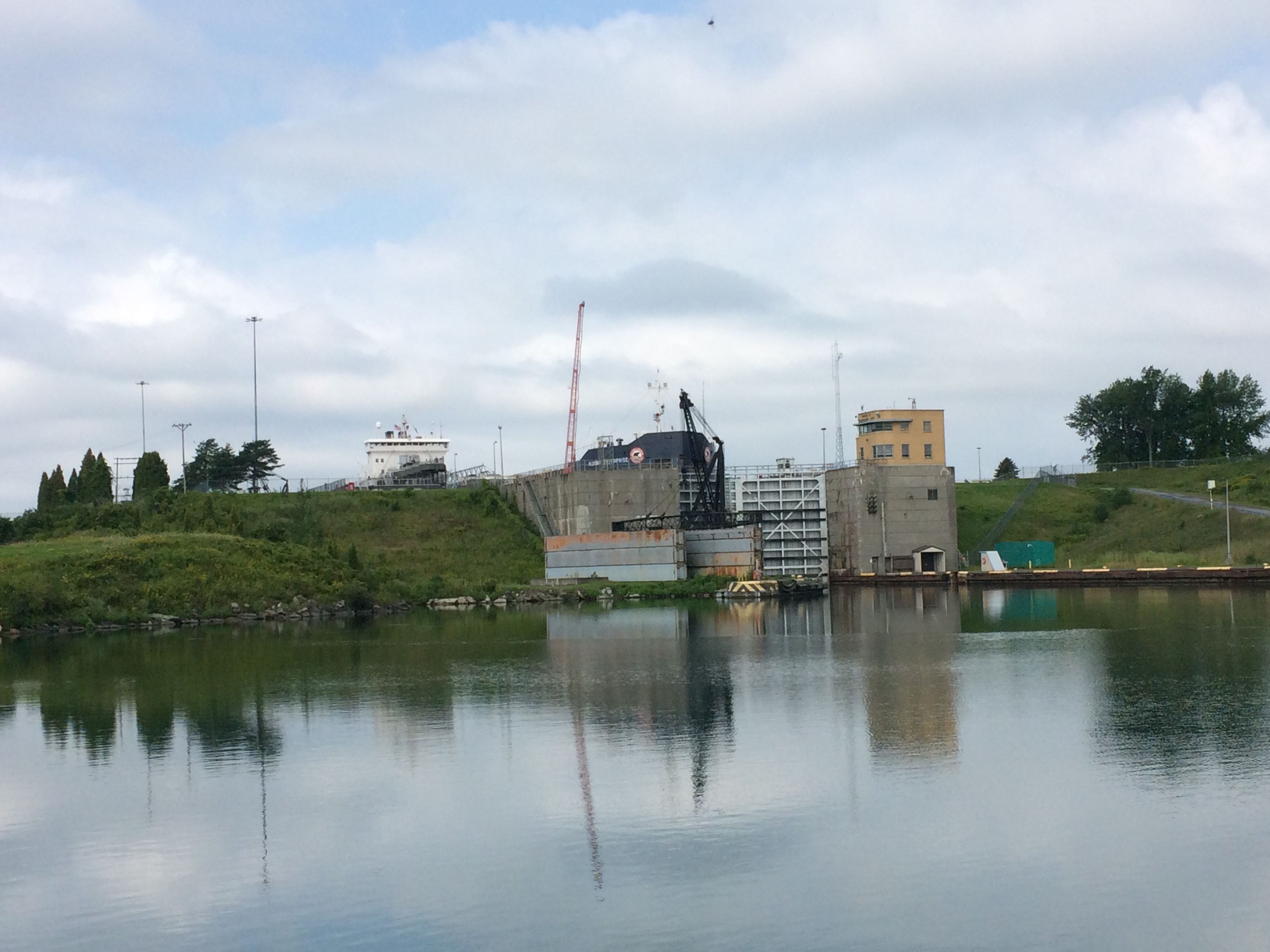
Bright and early the next day, we set off under cloudy skies. The deck was freshly rinsed with overnight rain. The channel gathered together now, split only by Cornwall Island, and a strong current ran on both sides of the island up to three knots. Our progress under the international Cornwall Bridge was frustratingly slow. Eventually, we made it to the entrance to the Snell lock, the first American lock.
Approaching the lock, we found the pleasure craft dock, tied up, and called the lockmaster from the requisite dedicated dockside phone. He instructed us to head directly into the lock as soon as the ship that was now exiting it was clear. He wasn’t sure we would be able to
Laker exiting Eisenhower lock
proceed directly through the next American lock, however, because several other ships were lined up to get through heading down the river.
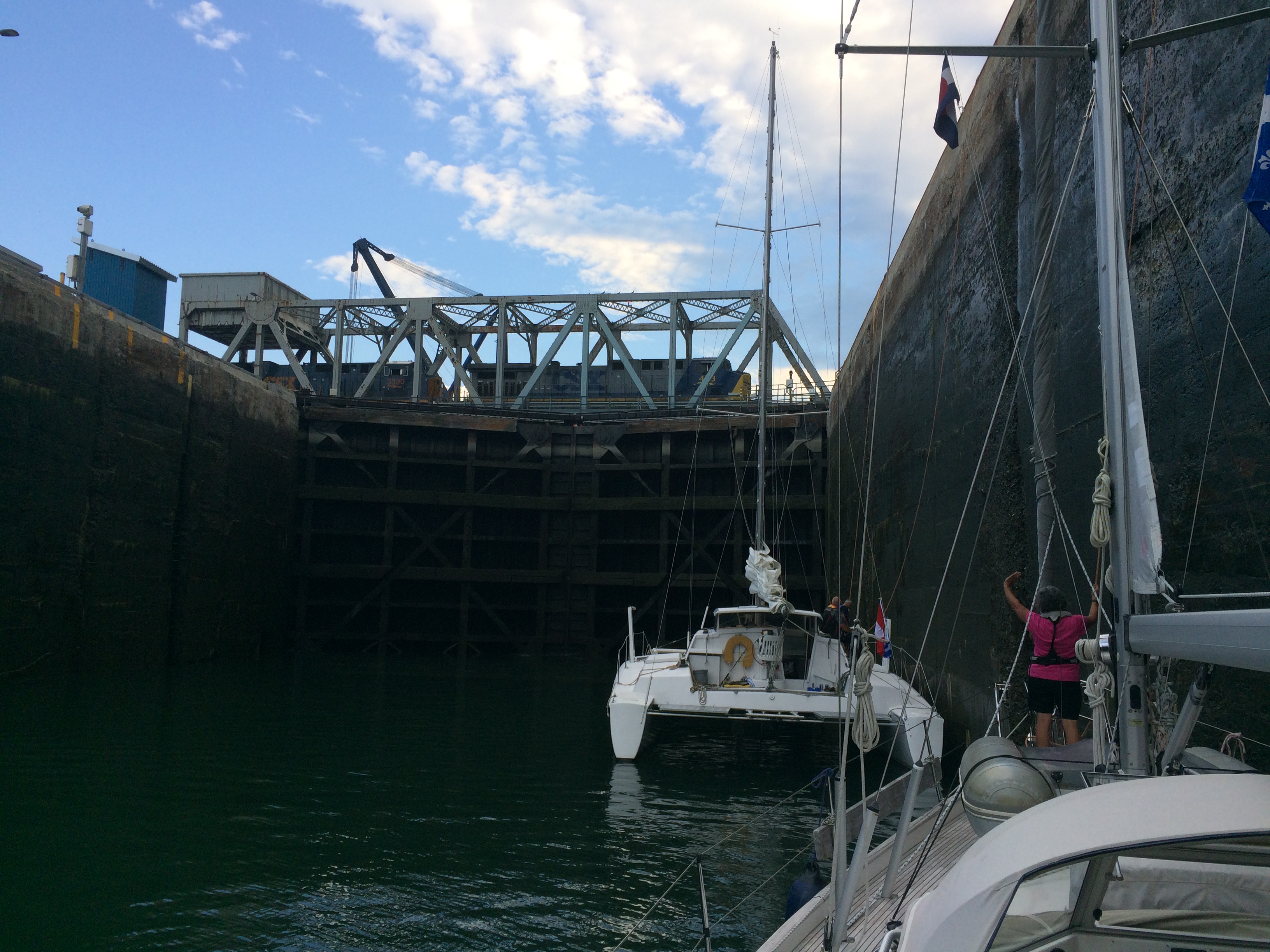
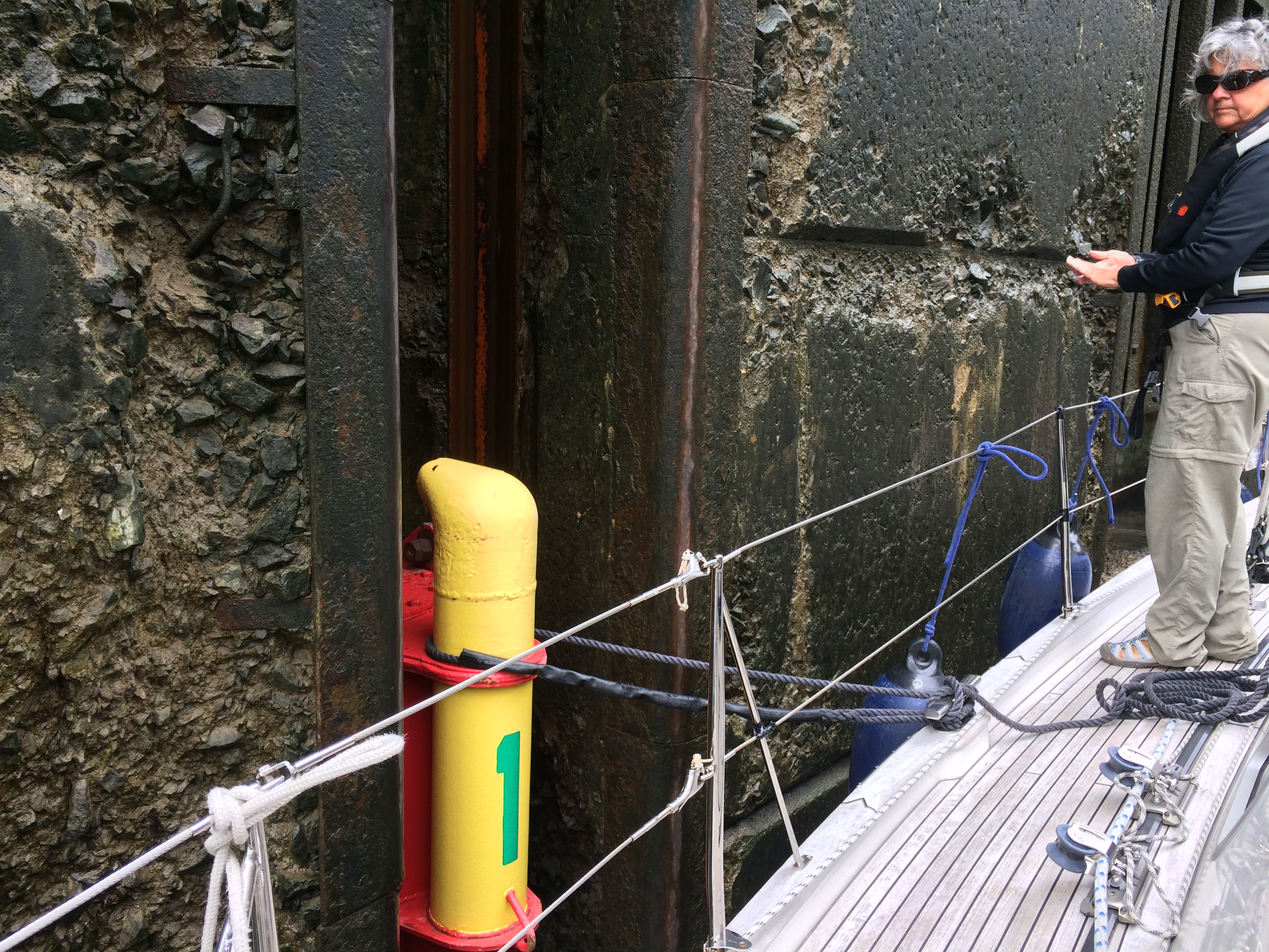
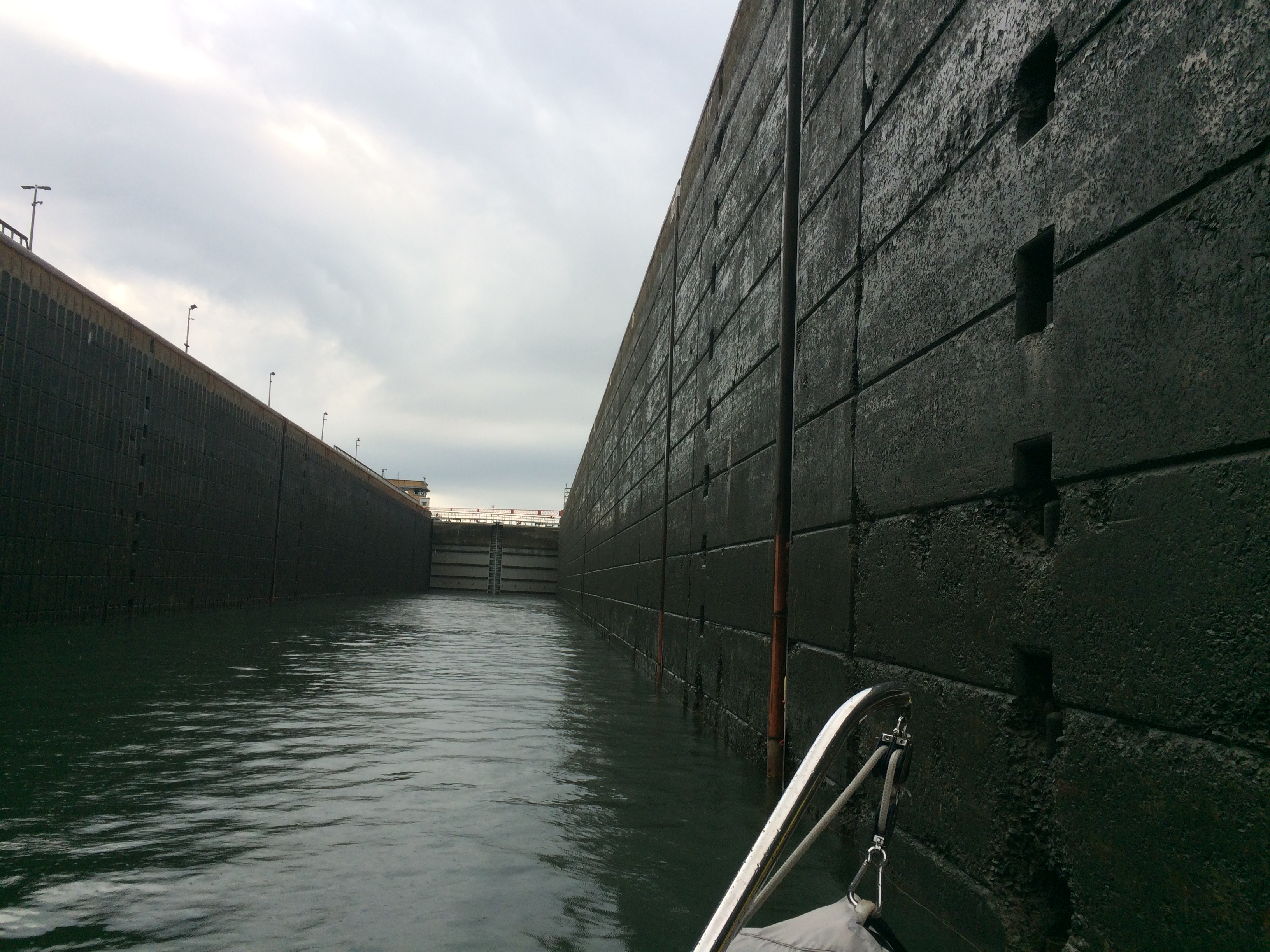
The first thing you notice about the American locks is their size. They are huge! The second thing you notice is that unlike in the Canadian locks the guys at the top of the wall are all wearing hard hats. I guess it’s “safety first” in the U.S. Instead of dropping lines down to us, we were instructed to use our own dock line to lasso a “floating bollard” recessed into the side of the lock wall. All alone in the huge lock, we motored to the front of the lock and took bollard number one.
Floating bollard inside American lock
It took only seven minutes for us to lock up a total of 14 meters (46 feet)! In that time, more than 90 million liters (nearly 24,000,000 gallons) of water had flooded into the lock. We noticed no turbulence as the lock was filling, leading us to wonder just how the water gets in there. Clearly, the lock is a true engineering marvel. At the top, I handed the lockmaster my pay.gov receipt for $60CAD and we were good to go.
BTW, even though we were in U.S. territory, an arrangement between the countries allows boats to transit the locks without clearing Customs and Immigration. This is because there is really no way to leave your vessel, so therefore technically boaters are not entering or leaving either country.
Water rising inside Snell lock
A three nautical mile canal connects the two locks. Once we arrived at the Eisenhower lock, we hailed the lock master on VHF Channel 12 as instructed. This time, he told us to take a mooring ball near the lock entrance where we would need to stand by until he could work us through the lock.
It took two hours before an opening developed, during which time we relaxed and witnessed three “big boys” enter, lower, and leave the lock. Finally, our turn came and once again we progressed through the lock, dwarfed by its size and using the floating bollard as before. On our exit, we gave the lock master a salute of thanks and motored away.
Our last lock was a bit anticlimactic. After departing the Eisenhower lock, we motored upwind and upstream for another 25 nautical miles to the Iroquois lock, our last lock along the St. Lawrence. Our timing was impeccable. As we arrived around 4 p.m. the green light was on. We got in line behind a few motor vessels and motored into the lock.
But something wasn’t right. Instead of entering a cavernous lock with high walls, this lock seemed almost full. When we noted this to the lock master, he straightened us out. The Iroquois lock only lifts boats one foot. Apparently, in this part of the river, a one foot drop creates enough current to wreak havoc with upbound ships, mandating one final lock before Lake Ontario. After only a few minutes in the lock, the upstream doors opened. We handed the lock master our payment receipt and moved on.
The day was waning, so we pulled over just after the lock and downstream of Toussaint Island to drop the hook and get some rest. The anchor set quickly and well, making for sound sleep. Tomorrow, we would move the final 35 nautical miles upriver into the heart of the Thousand Islands playground, our reward for the hard slog up the St. Lawrence River.
Comments
The Saint Lawrence Seaway — No Comments
HTML tags allowed in your comment: <a href="" title=""> <abbr title=""> <acronym title=""> <b> <blockquote cite=""> <cite> <code> <del datetime=""> <em> <i> <q cite=""> <s> <strike> <strong>