
Leg Three
Leg Three crewman John Renna arrived ready and able. He sets the standard for bringing the most important thing to the boat – a good attitude. Before leaving Port McNeill, we topped off the larder, beer hold, and diesel tank. Then, in drizzly mist, we started north.
The first night found us in a little cleft on the west shore of Hurst Island called God’s Pocket. The spot provides good shelter just off the top of Vancouver Island. From here, one must venture out from behind barrier islands into open ocean to round Cape Caution, which some find intimidating. Once past this cape, you can duck back in again behind islands to continue the voyage north in protected waters.
As originally conceived, the Leg Three cruising plan called for a 150-nautical-mile overnight passage to the Queen Charlotte Islands. Now, after talking with some other cruisers here, I’ve decided to alter the plan. Instead of the Queen Charlottes, we will work our way up the mainland coast, visiting “fjordland” and other attractions along the way.
Three considerations tipped the scales toward this decision. One, the prevailing wind is from the northwest, meaning Windleblo would be fighting wind and waves as she sailed south to north across open water to the Queen Charlotte Islands. Of course, a favorable weather window could have been found for the initial crossing, but eventually the northwesterlies would return, impeding progress. As always in this business, the wind helps make the decision.
Second, the Gwaii Hanaas rules are quite restrictive. Gwaii Hanaas is the national park reserve covering the southern (and most interesting) third of the Queen Charlotte Islands. Fees and red tape are necessary to visit. The rules are for a good reason – to protect the unique ecosystems and cultural attractions there – which is fine, except it requires a rigid itinerary, not desirable at this juncture.
The third consideration is the attractiveness of the Fjordland Recreation Area. Reading about it in the cruising guides and talking about it with locals make a favorable impression. Hot springs, secluded anchorages, good fishing and crabbing, and of course towering fjords all sound incredible. John and I talked it over his first night aboard and we decided we needed to go see it. Gwaii Hanaas can wait until next season.
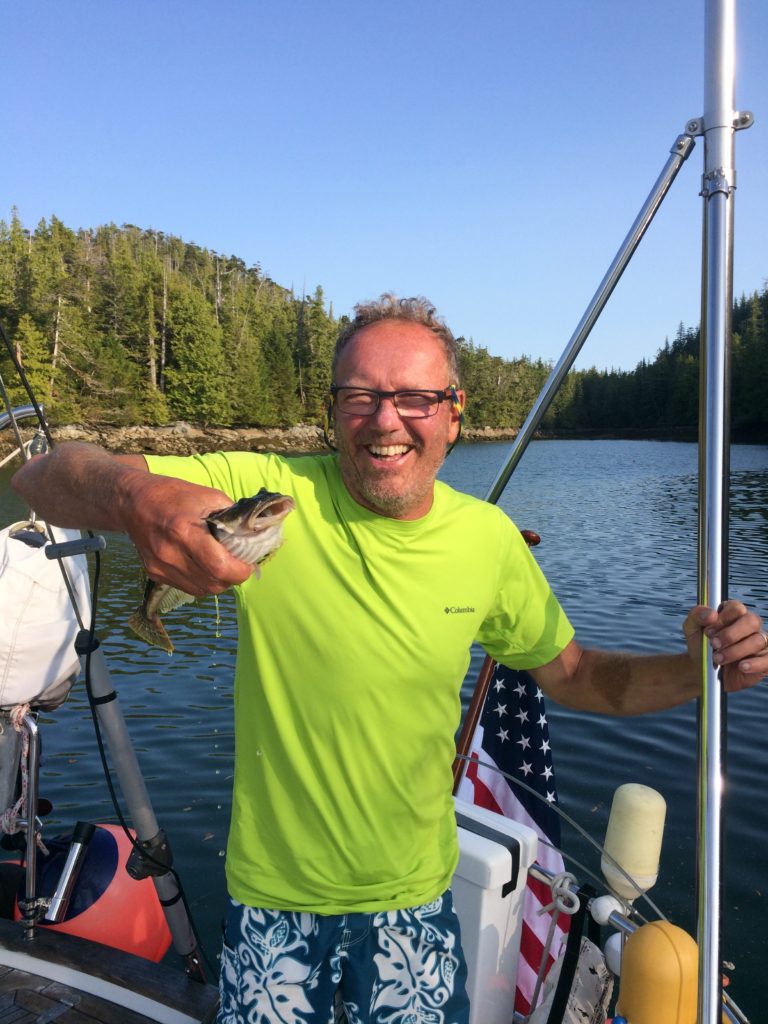
Though sometimes tempestuous, our rounding of Cape Caution was benign. The seas were smooth with half meter swells and light winds. Only fog made it interesting, but it burned off after a couple of hours. We continued our practice of keeping a keen watch for floating logs, a constant worry in these waters but nowhere near as intrusive as Maine lobster pots! We stopped in a cove on the northeast shore of Pine Island long enough to catch a rockfish using a jig lure I had bought in Norway.
Fury Cove is the classic terminus for a day sail north around Cape Caution. We entered this fine cove and dropped the anchor in good mud, 10 meters deep. A white shell beach beckoned for a walk ashore. North of Cape Caution, we had now entered the Central Coast of British Columbia. Everything felt a bit bigger, a bit more remote.
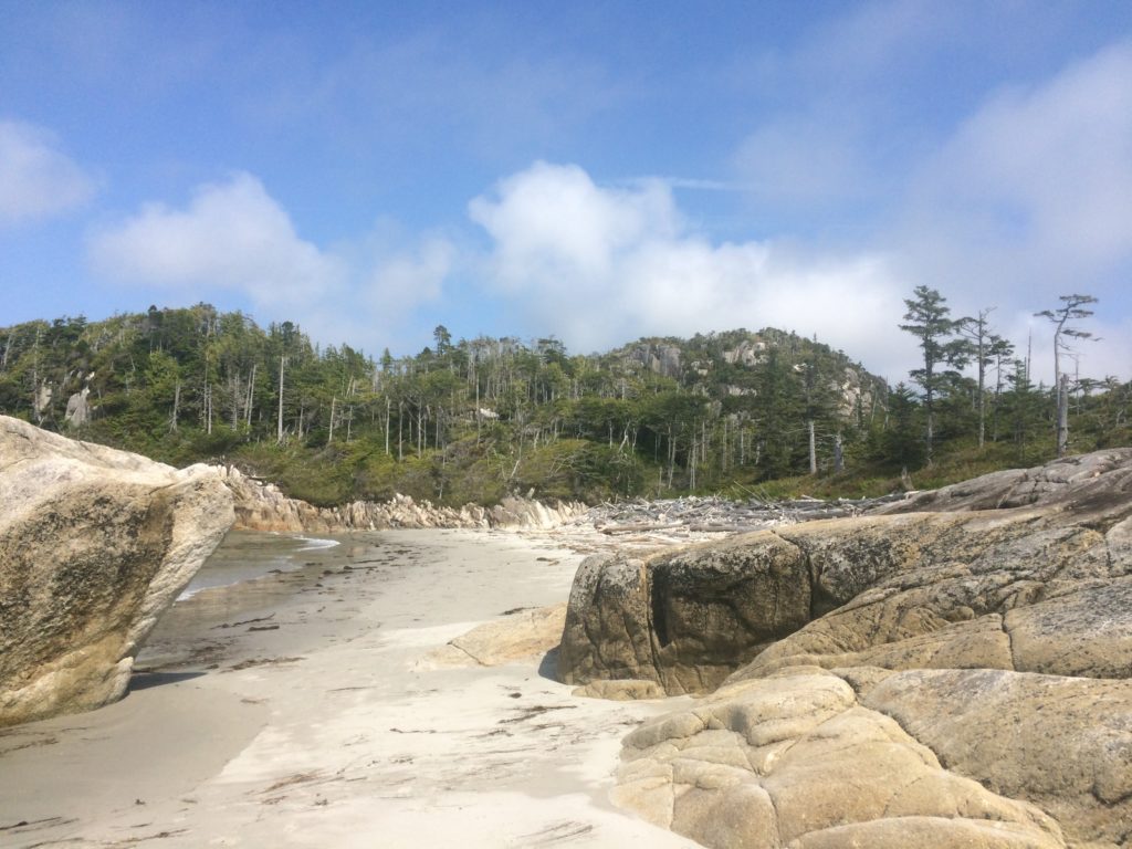
Next morning, a cracking good sail 20-nautical-miles up Fitz Hugh Sound led us to Pruth Bay near the north end of Calvert Island. Here, we joined several boats at anchor just off a large dock. The attraction? Free wifi, the only connectivity for many, many miles, provided courtesy of the Hakai Institute, an academic center for the study of British Columbia coastal ecosystems. The center welcomes visiting yachtsmen, even providing an open wifi network across the campus. The setting is stunningly beautiful. Several solid buildings capped with red metal roofs lie surrounded by thick forest. Well maintained trails lead to the best beaches in British Columbia. We hiked to all the beaches, thinking how great it would be to be a professor on sabbatical here. On our hike we encountered a group of volunteers removing trash from the beaches, including jetsam from Japan! A videographer was operating a drone camera to film the process. We asked him where the video could be seen and he referred us to the institute’s YouTube channel!
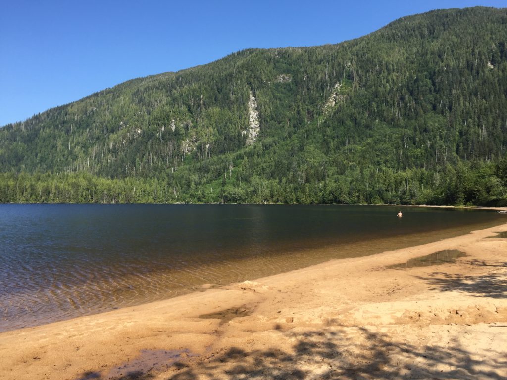
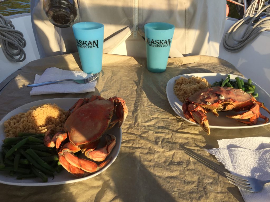
Next day we motored to a spot called Codville Lagoon. Here, another well maintained trail led up to yet another fine beach, this one on a freshwater lake. Though the morning started out foggy, the afternoon cleared off and we enjoyed a fine sunny afternoon beach combing and swimming in the salt free and almost warm water. That evening, the crab trap yielded two Dungeness crabs. Crab feast for dinner!
Our only chance for reprovisioning came at Bella Bella, the halfway point for Leg Three. We tied up at the municipal dock and found a well-stocked grocery store just past the head of the dock. Bella Bella is a First Nation community. Almost all residents are Native American. After shopping, we didn’t stay long but long enough to see that the small town did not have much to recommend it. Modest homes, some poorly maintained but each with a TV satellite dish, were interspersed with empty lots strewn with trash and rubble. On the plus side, a beautiful K-12 school stood proudly and a large new community center was under construction at the center of town.
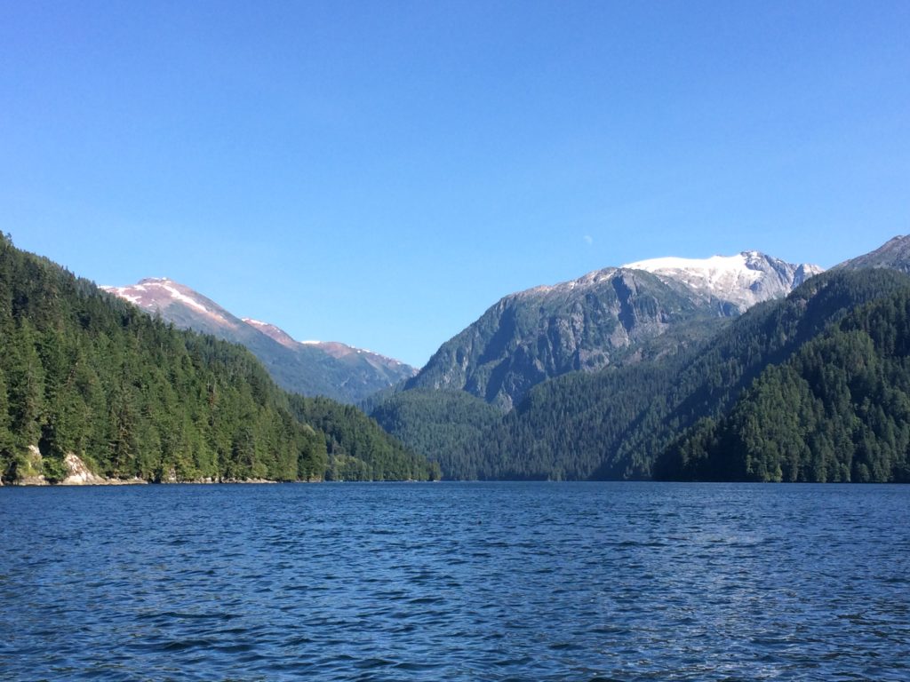
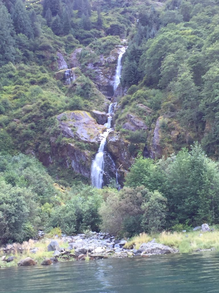
From Bella Bella, we continued north into the heart of fjordland. Our first exposure to the incredible scenery was at Kynoch Inlet. We anchored just outside the narrow entrance to Culpepper Lagoon and launched the dinghy for an exploratory tour. Just before entering, we spied two bears foraging for fish in a creek outlet near our anchorage. As elsewhere on this leg, many bald eagles were seen. Once inside the lagoon, we were not disappointed. Towering snow-capped peaks reached up from the water, rivaling the best I had seen in Norway. Next day, following breezes pulled us up Princess Royal Channel and into Khutze Inlet, another incredible fjord where similar vistas were beheld. This time, we shared the views with people in three trawlers at anchor at the head of the inlet.
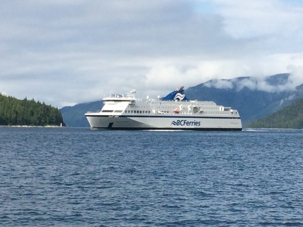
Pressing on, now we were transiting part of the Marine Highway, which is the main ferry route to Alaska. Near the north end of the Princess Royal Channel, we were treated to a delightful show by a playful minke whale who breached repeatedly as we motored by. As the whale faded from view to our stern, the first large ferry we’d seen this far north entered the channel heading south. An announcement of the playful whale must have been made on board as we could see people lining the rails ready to take in the show.
Perhaps most memorable of all is our stop at Bishop Hot Springs. The anchor was not needed here as we chose from three empty mooring balls upon arrival. A small dock and ramp provided a place to tie up the dinghy and get to shore. Once there, we took a boardwalk leading to the hot spring. Volunteers had constructed two separate pools enclosed in concrete and rimmed by a deck. A modest changing room completed the installation. Hot water from the spring fed the upper pool through a three inch sturdy hose. A sign said the water temperature was 40 degrees Celsius (around 105 Fahrenheit). It didn’t feel that hot to me as I had no trouble soaking in it for a good while. The second lower pool was plenty warm but not as hot as the upper pool, inviting a longer soak. John and I had the springs all to ourselves for a couple of hours. We decided to take a layover day for extra time to soak. Several fast boats came and went over the course of our stay, but it never felt crowded.
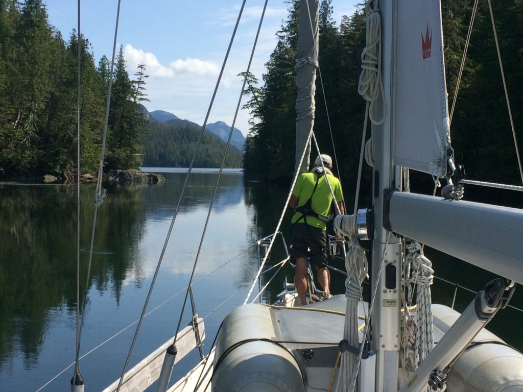
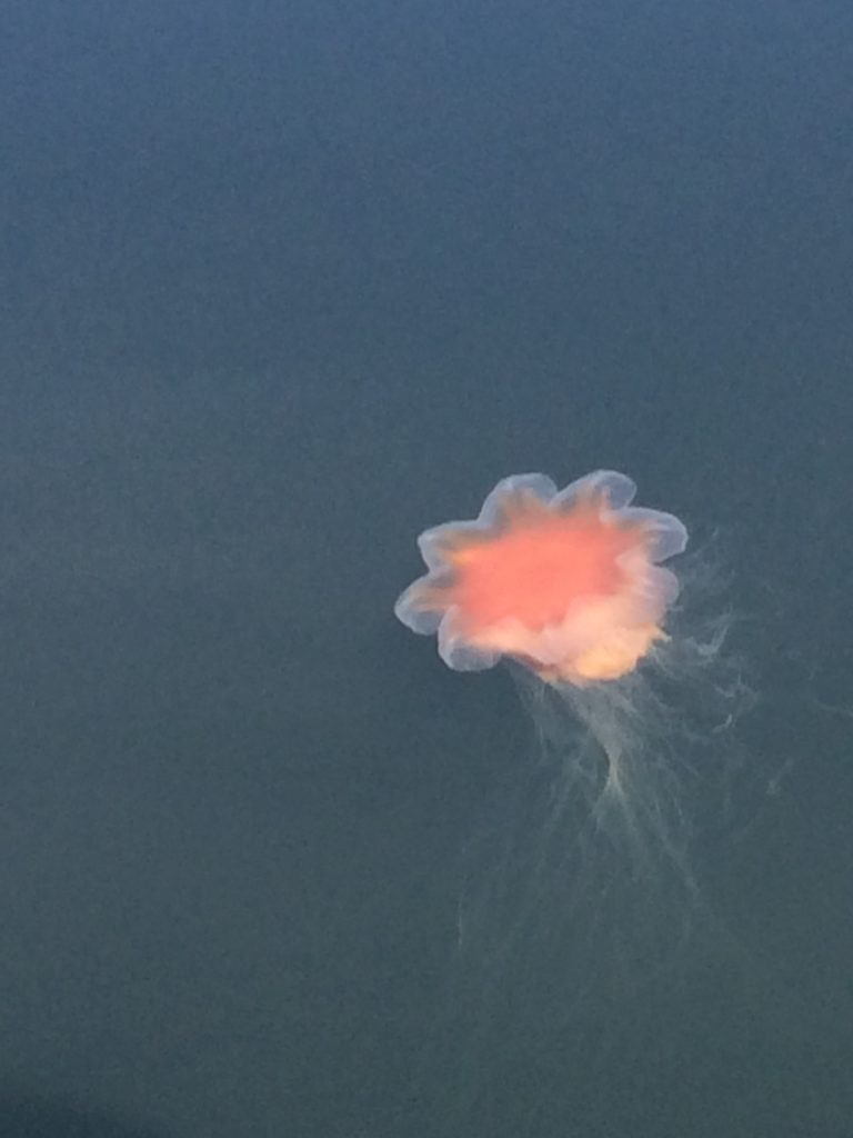
Continuing on, we chose the Principe Channel for our final stretch. So much motoring through narrow channels made me long for more open waters and the promise of some wind for sailing. Principe Channel promised relief. Blessedly, each day offered gentle or moderate breezes for sailing in between a succession of quiet wilderness anchorages. Each anchorage was remarkable for its beauty and remoteness. We marveled at monster jellyfish in Ire Inlet, said hello to a friendly harbor seal in Colby Bay, and gazed at a brilliant full moon at Spicer Island cove. Sadly, we were unable to find any fish to bite our hook or crabs to enter our trap here. It seems the early Leg Three fishing and crabbing success was beginner’s luck. Perhaps a greater down side was the lack of opportunities to access the shore for a stretch of the legs. Steep forbidding rock and impenetrable forest form each shore, making any thought of landing impossible. On the final push into Prince Rupert, I realized that this last week of Leg Three could be the deepest wilderness yet for the Windleblo.
With Alaska very close now, more awaits.
Comments
Leg Three — No Comments
HTML tags allowed in your comment: <a href="" title=""> <abbr title=""> <acronym title=""> <b> <blockquote cite=""> <cite> <code> <del datetime=""> <em> <i> <q cite=""> <s> <strike> <strong>